Showing posts with label Hawaii. Show all posts

Hawaiian Island swallowed by sea

SUBHEAD: Hurricane and rising seas claim East Island of French Frigate Shoals in Marine National Monument.

By Jessica Corbett on 24 October 2018 for Common Dreams -
(https://www.commondreams.org/news/2018/10/24/hawaiian-island-swallowed-rising-seas-after-hurricane-walaka-reveals-what-future)


Image above: East Island in Hawaii before it was swallowed up by the Pacific Ocean after a powerful hurricane struck the region. Photo from Chip Fletcher. From original article.

Offering a warning of what's to come as human-caused global warming increasingly exacerbates extreme weather, scientists have determined that Hurricane Walaka—one the Pacific's most powerful storms ever—washed away a remote and ecologically important 11-acre island in Northwestern Hawaii.

East Island was part of French Frigate Shoals in the Papahanaumokuakea Marine National Monument and, according to the Honolulu Civil Beat, "a critical habitat for endangered Hawaiian monk seals and green sea turtles."

While researchers expected that the gravel and sand island, perched atop a coral reef, would eventually disappear into the rising seas, the discovery—facilitated by satellite imagery—caught Chip Fletcher, a professor of earth sciences at the University of Hawaii, and his colleagues by surprise.

"I had a holy shit moment, thinking 'Oh my God, it's gone,'" said Fletcher, who had conducted research on the island in July. "It's one more chink in the wall of the network of ecosystem diversity on this planet that is being dismantled."

The extent of the ecological damage and whether the island will ever return is still unknown, but about a seventh of the entire population of Hawaiian monk seals—one of the most endangered marine mammals—was born on East Island, and more than half of all Hawaiian green sea turtles—which are classified as threatened under the Endangered Species Act—had nested on it.


Image above: An 11-acre island in Hawaii has disappeared because of storm surges. “This event is confronting us with what the future could look like.” Photo from Chip Fletcher. From original article.

Randy Kosaki, the monument's deputy superintendent for research and field operations for the National Oceanic and Atmospheric Administration (NOAA), said the French Frigate Shoals have now lost two islands in the same number of months.

"The take-home message is climate change is real and it's happening now," concluded Kosaki. "It's not a hoax propagated in China as some folks have said," an apparent reference to President Donald Trump's remarks that resurfaced during his campaign.

"These small, sandy islets are going to really struggle to persist" as the seas rise because of anthropogenic global warming, Charles Littnan, director of NOAA's protected species division, told the Huffington Post. "This event is confronting us with what the future could look like."

Bill McKibben, co-founder of 350.org, concurred that the island's disappearance is a warning to humanity. "We're going to see a lot of these stories in the years ahead, and every one will be so sad," he tweeted.

The take-home message is climate change is real and it's happening now.


.

Uncomfortable Truth about Hawaii

SUBHEAD: The illegal takeover of the Hawaii was an act of war and never resolved with peace.

By Keanu Sai on 16 August 2018 for University of Hawaii -
(https://islandbreath.blogspot.com/2018/10/uncomfortable-truth-about-hawaii.html)


Image above: Still frame from video of  Na Moolelo Lecture Series lecture at University of Hawaii-Windward Community College. See below.

[IB Publisher's note: A mahalo to Craig Davies, of Kauai, for the link to this lecture on Hawaiian history and loss of independence.]

Dr. Keanu Sai is a political scientist specializing in international relations and public law, as well as a faculty member at the University of Hawaii-Windward Community College and an adjunct faculty member at the University of Hawaii College of Education.

He addressed the concept of “act of war,” as well as its implications and consequences in the context of international law. The discussion, “An Uncomfortable Truth: Hawaii has been in a State of War with the United States since 1893,” took place on June 13.

Na Moolelo Lecture Series: The Na Moolelo Lecture Series is an opportunity for the public to learn from Hawaiian cultural experts, historians and other museum professionals who prompt discussion of Hawaiian history and culture as well as museum practices.

The free series supports Iolani Palace’s mission to preserve and share Hawaii’s unique cultural and historical qualities with the community.


Video above: Still frame from video of lecture "An Uncomfortable Truth: Hawaii in a State of War" by Dr. Keanu Sai.

.

Less rats mean more birds and fish

SUBHEAD: Rodent eradication saves chicks and fertilizes soil and reefs for better biodiversity.

By Jan TenBruggencate on 6 July 2018 for Raising Islands -
(http://raisingislands.blogspot.com/2018/07/new-study-finds-rat-eradication.html)


Image above: Rat in tree eating Hawaiian bird eggs. From (https://conservationbytes.com/2015/01/06/help-hawaiis-hyper-threatened-birds/).

If the rat eradication of Lehua Island (in Kauai County, Hawaii) ends up being successful, it could result in a more productive nearshore fishery.

Which is ironic, in that many of those fighting the eradication program were fishermen.

A new study in the journal Nature says that when rats kill off seabirds on islands, it means those birds are no longer pooping in the nearshore waters, fertilizing reefs. And that means fewer fish on those reefs.

This study was done in the Chagos Archipelago, where some islands have rats and others are rat-free. Researchers looked at both the fertility of the land on those islands and the productivity of their reefs, where erosion from the land would carry nutrients like bird-poop-sourced nitrogen.

The Chagos are atolls and reefs just south of the Equator in the Indian Ocean. Their ownership is disputed between Great Britain and Mauritius. One is Diego Garcia, which houses a U.S military base.

The results of the research were clear, said the authors, who are from Australian, British, Danish and Canadian research institutions.

On islands without rats, seabird density as well as nitrogen deposits were hundreds of times higher. Yes, hundreds: 250 to more than 700 times higher.

Those rat-free islands had reefs that had 48 percent more biomass of "macroalgae, filter-feeding sponges, turf algae and fish."

The researchers looked specifically at damselfish, and found that they both grew faster and had higher total biomass on the rat-free islands.

The theory, then, is that seabirds feed in the open ocean, deliver bird poop to the islands, and that the islands then feed the nearshore waters, which makes the waters more productive and capable of producing more fish.

"Rat eradication on oceanic islands should be a high conservation priority as it is likely to benefit terrestrial ecosystems and enhance coral reef productivity and functioning by restoring seabird-derived nutrient subsidies from large areas of ocean," the authors wrote.

Rats are not the only problems on islands. On Midway Atoll, near the western end of the Hawaiian archipelago, mice began eating seabirds after rats were removed from the islands there. The case of the vampire mice, which chewed into the necks of Laysan albatross, is reviewed here.

On other islands, the mice even seemed to be getting bigger on their diets of eggs and bird flesh. The Washington Post was among the many international publications that picked up the vampire mouse story.

All that said, rodents mainly go after eggs and chicks of nesting seabirds. That was the case at Lehua Island. Here is a description of the situation on the little island north of Ni`ihau before an application of a rodenticide to try to wipe out the rats.

"We found Wedge-tailed Shearwater and Red-tailed Tropicbird eggs broken open, the edges gnawed, the insides consumed. Tiny seabird chick bodies were commonplace–pulled out of burrows and half eaten.

This was particularly true for the diminutive Bulwer’s Petrel–the vast majority of Bulwer’s Petrel burrows we found had bits and pieces of chick inside," wrote Andre Raine, Project Manager for the Kauai Endangered Seabird Recovery Project.

A couple of months after the 2017 rat eradication effort at Lehua, Raine said he could clearly see the difference:

"Fat, healthy Wedge-tailed Shearwater chicks shuffled about in their burrows looking like animated fuzzballs. One of our burrow cameras showed a Bulwer’s Petrel chick exercising outside its burrow and actually fledging – a great omen, as this is something we have never recorded on our cameras in previous years," he wrote.

Most, but not all the rats were killed off at Lehua, and wildlife crews were back this year with rat-hunting dogs to try to kill off the survivors and protect the island's nesting seabird population.

And the island's coastal reefs and fisheries.
The removal of rats from islands is a major conservation effort. It has been done successfully at islands in Hawai`i like Mokoli`i off O`ahu and Mokapu off Molokai.

When it was accomplished at Palmyra Atoll south of the Hawaiian Islands, it had the unintended effect of killing off the disease-causing Asian tiger mosquito, which had depended on rats for blood meals. 
.

Fuck RIMPAC 2018!

SUBHEAD: These exercises are a colossal waste of resources and energy that only demonstrate America's suicidal death spiral. 

By Juan Wilson on 29 June 2018 for Island Breath -
(http://islandbreath.blogspot.com/2018/06/fuck-rimpac-2018.html)


Image above: Naval participants on RIMPAC 2018 on parade for a photo op. From (https://news.usni.org/2018/06/26/rim-of-the-pacific-2018-participation).

For those that don't know RIMPAC is the U.S. Navy term for the "Rim of the Pacific. Evert two years the Navy puts together a nautical dog and pony show that they call RIMPAC "xxxx", where the "xxxx" is the even numbered year in which it takes place.

"Friendly" navy allies from nations proximate to the Pacific Ocean are invited to join the festivities on land, sea and in the air experimenting with new weapons systems, setting off explosives and coordinating he destruction of the planet Earth.

The US Navy likes to show its magnanimity by inviting "potential enemy" nations like China and Russia to join in as observers presumably to scare the crap out of them with the broad show of force. This also gives the nation the option of punishing an "enemy" observer nations with a dis-invitation if they do something we don't like.

This year China was dis-invited (https://www.militarytimes.com/news/your-military/2018/05/23/china-was-just-uninvited-from-rimpac-heres-why/) because it had the gall to continue to build up its presence in the South China Sea. Heaven forfend!

Well here we are again. This year is "RIMPAC 2018"... and it is going on now. Why "Fuck RIMPAC 2018!"? Because it is a costly public relations stunt that pollutes the ocean and kills uncounted numbers of sea creatures. Something we don't need any more of.

Through World War II to date the United States has dominated the Pacific Ocean through diabolic destruction with nuclear weapons and unfettered domination of island peoples. It is a disgusting display.

These RIMPAC war game are headquartered in Hawaii, with Pearl Harbor (on Oahu) and the Pacific Missile Range Facility (on Kauai) playing a major role.

If you don't think these "games" come at a cost to us living on Kauai you are dead wrong. Just go back to our post whale on pod stranding of a whale in Hanalei Bay in 2004 due to RIMPAC activities at the bottom of the list or articles below for a taste of the US Navy's games.

See also:
Ea O Ka Aina: Civil Beat views US military in Pacific 8/20/17
Ea O Ka Aina: "No!" to American Militarism 4/11/17
Ea O Ka Aina: DLNR responsibility on RIMPAC 7/6/16
Ea O Ka Aina: Participation in RIMPAC 2016 6/1/16
Ea O Ka Aina: Judgement against RIMPAC 2016 5/29/16
Ea O Ka Aina: Prepare for RIMPAC War in Hawaii 5/22/16
Ea O Ka Aina: Navy to "take" millions of mammals 5/1
Ea O Ka Aina: Judgement against RIMPAC 2016 4/3/16 
Ea O Ka Aina: Navy's "illegal" War Game 11/17/15
Ea O Ka Aina: US court RIMPAC Impact decision 4/3/15
Ea O Ka Aina: RIMPAC 2014 Impact Postmortem 10/22/14
Ea O Ka Aina: RIMPAC 2014 - another whale death 7/26/14
Ea O Ka Aina: RIMPAC 2014 in Full March 7/16/14
Ea O Ka Aina: 21st Century Energy Wars 7/10/14
Ea O Ka Aina: RIMPAC War on the Ocean 7/3/14
Ea O Ka Aina: Voila - World War Three 7/1/14
Ea O Ka Aina: The Pacific Pivot 6/28/14
Ea O Ka Aina: RIMPAC IMPACT 6/8/14
Ea O Ka Aina: RIMPAC Then and Now 5/16/14
Ea O Ka Aina: Earthday TPP Fukushima RIMPAC 4/22/14
Ea O Ka Aina: The Asian Pivot - An ugly dance 12/5/13
Ea O Ka Aina: Help save Mariana Islands 11/13/13
Ea O Ka Aina: End RimPac destruction of Pacific 11/1/13 
Ea O Ka Aina: Moana Nui Confereence 11/1/13
Ea O Ka Aina: Navy to conquer Marianas again  9/3/13
Ea O Ka Aina: Pagan Island beauty threatened 10/26/13
Ea O Ka Aina: Navy license to kill 10/27/12 
Ea O Ka Aina: Sleepwalking through destruction 7/16/12
Ea O Ka Aina: Okinawa breathes easier 4/27/12
Ea O Ka Aina: Navy Next-War-Itis 4/13/12
Ea O Ka Aina: America bullies Koreans 4/13/12
Ea O Ka Aina: Despoiling Jeju island coast begins 3/7/12
Ea O Ka Aina: Jeju Islanders protests Navy Base 2/29/12
Ea O Ka Aina: Hawaii - Start of American Empire 2/26/12
Ea O Ka Aina: Korean Island of Peace 2/26/12   
Ea O Ka Aina: Military schmoozes Guam & Hawaii 3/17/11
Ea O Ka Aina: In Search of Real Security - One 8/31/10
Ea O Ka Aina: Peace for the Blue Continent 8/10/10
Ea O Ka Aina: Shift in Pacific Power Balance 8/5/10
Ea O Ka Aina: RIMPAC to expand activities 8/3/10
Ea O Ka Aina: RIMPAC War Games here in July 6/20/10
Ea O Ka Aina: Pacific Resistance to U.S. Military 5/24/10
Ea O Ka Aina: Guam Land Grab 11/30/09
Ea O Ka Aina: Guam as a modern Bikini Atoll 12/25/09
Ea O Ka Aina: GUAM - Another Strategic Island 11/8/09
Ea O Ka Aina: Diego Garcia - Another stolen island 11/6/09
Ea O Ka Aina: DARPA & Super-Cavitation on Kauai 3/24/09
Island Breath: RIMPAC 2008 - Navy fired up in Hawaii 7/2/08
Island Breath: RIMPAC 2008 uses destructive sonar 4/22/08
Island Breath: Navy Plans for the Pacific 9/3/07
Island Breath: Judge restricts sonar off California 08/07/07
Island Breath: RIMPAC 2006 sonar compromise 7/9/06
Island Breath: RIMPAC 2006 - Impact on Ocean 5/23/06
Island Breath: RIMPAC 2004 - Whale strandings on Kauai 9/2/04
.

USGS info on Kilauea Volcano

SUBHEAD: How much danger is there of massive tsunami caused by collapse of East Rift Zone area?

By Staff on 28 June 2018 for United States Geological Survey -
(https://volcanoes.usgs.gov/observatories/hvo/)


Image above: Photo from south of Puna as Kilauea volcano lava enters Pacific Ocean causing clouds of steam and vog. From (https://www.inverse.com/article/46466-kilauea-volcano-ocean-entry-deemed-hazardous-as-dangerous-laze-persists).

[IB Publisher's note: There is a wide range of opinions about the danger imposed by current volcanic activity on the Big Island of Hawaii. Some fear the risks are being minimized to keep people calm and not scare tourists away. Some even fear a catastrophe of biblical proportions is imminent. Below are recent reports by the United States Geological Survey. They may be hiding the truth to allay a panic. But they, more than any other source, have the real data. Here are some of their recent reports to the public.]

Answers to Questions about Kīlauea Volcano's earthquakes
June 28, 2018

The summit area of Kīlauea Volcano has undergone significant changes since April 2018. On April 21, the lava lake within Halema‘uma‘u overflowed onto the crater floor as the volcano's magmatic system pressurized.

On April 30, the floor of the Pu‘u ‘Ō‘ō crater collapsed, as subsurface pressure forced open a pathway for magma to travel from Pu‘u ‘Ō‘ō into the lower East Rift Zone. As magma moved into the lower East Rift Zone, pressure decreased in the summit's magmatic system and the lava lake level began to drop. The summit also started to deflate due to the pressure decrease.

As summit deflation (or subsidence) persisted, the number of earthquakes increased. Prior to the onset of deflation, about 10 earthquakes per day were typical at the summit. As of late June 2018, there are about 600 earthquakes located in the same region on a daily basis. Many of these earthquakes are strong enough to be felt, and some can be damaging.

These earthquakes are understandably causing concern, especially in Volcano Village and surrounding subdivisions. These Frequently Asked Questions about Kīlauea Volcano's Summit Earthquakes will help answer some of the most commonly asked questions about the nature of Kīlauea's summit activity, and the numerous earthquakes that are occurring in the area.


Saying "goodbye" to one GPS station and "hello" to two more
June 25, 2018

On June 18, Hawaiian Volcano Observatory staff said a sad goodbye to a GPS instrument that had faithfully recorded over 95 m (310 ft) of downward motion of the floor of Kīlauea caldera before losing radio contact. The GPS instrument, called NPIT, first started moving downward in early May at the onset of subsidence at Kīlauea's summit.

However on June 8, NPIT's motion picked up dramatically. This was when a portion of the caldera floor north of Halema'uma'u, where NPIT was located, began to slump into the crater. Over the next ten days NPIT GPS recorded down-dropping of 6-8 m (20-25 ft) with each summit explosion event, which have been occurring almost every day.

This, together with earlier displacements, added up to a position change of 95 m down, 55 m south, and 5 m east (310 ft, 180 ft, and 16 ft, respectively).

These data provide unique insight into the crater collapse process, showing us that it is occurring as a series of steps instead of as continuous motion. Drone and helicopter views confirm that NPIT is still intact and likely still recording data.

Unfortunately, the large motions have now resulted in a misalignment of the radio shot between the instrument and the observatory, cutting off communication and therefore data flow from the GPS station.

At about the same time that we lost the ability to contact NPIT, HVO staff completed work to add telemetry to two temporary GPS stations on the caldera floor.

These two stations, called CALS and VO46, are not located on actively slumping portions of the caldera floor and therefore do not show the dramatic downward motion that NPIT did.

However, they reveal that even portions of the caldera floor away from active slumping are moving downward very quickly; by as much as 1.0 m per day (3.3 feet per day) at station CALS. The data from these new stations can be viewed on the deformation page for Kīlauea.


Why so many earthquakes in the Kīlauea summit area?
May 29, 2018

Deflation at Kīlauea's summit has caused up to 1.5 meters (about 5 feet) of subsidence, which has stressed the faults around and within Kīlauea Caldera. Read more


GPS monitoring reveal where magma has moved
May 24, 2018

Kīlauea Volcano is currently erupting at two locations: from Halema‘uma‘u, a crater within the summit caldera, and from the lower East Rift Zone (LERZ) in and near the Leilani Estates and Lanipuna subdivisions.

Small explosive episodes at Kīlauea's summit are a consequence of magma withdrawing from a shallow reservoir beneath the east margin of Halema‘uma‘u. The eruption of lava along the LERZ resulted from the underground movement of magma eastward from the volcano's middle East Rift Zone.


Image above: Illustration of Kīlauea Volcano from the summit caldera to the lower East Rift Zone (LERZ). Blue arrows = contraction across the upper and middle rift zone, black arrows = expansion in LERZ. From original article.

GPS, tiltmeters, and satellite radar (InSAR) data captured how Kīlauea's surface has moved since the Pu‘u ‘Ō‘ō vent collapsed on April 30, 2018. These data allow scientists to infer where magma was removed and the location to which it was transferred. In the first days following the collapse of Pu‘u ‘Ō‘ō, the largest signals indicated contraction across the upper and middle East Rift Zone—evidence that magma was being withdrawn from this area.

This was followed by expansion across the LERZ—evidence that magma was intruding into this part of the rift zone at depths of less than about 3 km (2 mi). The forceful widening of the LERZ continued through May 18, at which time a GPS site north of the intrusion stopped moving northwestward and stabilized.

In early May, days after the collapse of Pu‘u ‘Ō‘ō, the lava lake level in Halema‘uma‘u began to drop as the summit area subsided at a high rate. The lava lake surface disappeared from view on about May 10, at a depth of more than 325 m (1,070 ft) below the Halema‘uma‘u crater floor.


Image above: This plot shows vertical displacement of a USGS GPS (CRIM) station from April 26 to May 24, 2018. From original article.

Subsidence of the summit area continues. Between May 1 and May 24 the caldera floor subsided as much as 1.4 m (4.5 ft). The GPS station, labeled as CRIM on the edge of Kīlauea's summit caldera [Fig.2], has subsided about 0.6 m (1.9 ft).

Continued summit subsidence indicates that magma is moving from the summit magma reservoir and into the East Rift Zone at a higher rate than magma is entering the reservoir from below. To date, geochemical analysis of erupted lava indicates that summit magma has not yet erupted from the LERZ fissures 1-23.


Facts on stability of Kīlauea's south flank, past and present
 May 14, 2018

There have been several recent highly speculative stories, rumors and blogs about the stability of the south flank of Kīlauea and the potential for a catastrophic collapse that could generate a Pacific-wide tsunami. We wish to put these speculations in their proper context by presenting observations of the current situation and an assessment of past evidence of landslides from Kīlauea.

There is no geologic evidence for past catastrophic collapses of Kīlauea Volcano that would lead to a major Pacific tsunami, and such an event is extremely unlikely in the future based on monitoring of surface deformation. Kīlauea tends to "slump", which is a slower type of movement that is not associated with tsunamis, although localized tsunamis only affecting the island have been generated by strong earthquakes in the past.

The May 4 M6.9 earthquake resulted in seaward motion of approximately 0.5 m (1.5 ft) along portions of Kīlauea's south flank as measured by GPS stations across the volcano.

A preliminary model suggests that the motion was caused by up to 2.5 meters (8 feet) of slip along the fault that underlies the volcano's south flank, at the interface between the volcano and the ocean floor, about 7-9 km (4-6 mi) beneath the surface.

This motion is within the expected range for a large earthquake on this fault. The earthquake was probably caused by pressure exerted by the magmatic intrusion on the south flank fault, following the pattern of past earthquake activity that has been observed during Kīlauea East Rift Zone intrusions.

A small, very localized tsunami did occur as a result of the fault slip. Similar local tsunamis were generated by past large earthquakes, including the 1975 M7.7 and 1868 ~M8 events, both of which resulted in multiple deaths along the south coast of the Island of Hawai‘i.

Adjustments on the south flank caused another ~9 cm (3.5 inches) of motion at the surface in the day after the earthquake, followed by another 2-3 cm (~1 inch) since May 5.

This is higher than the normal rate of south flank motion (~8 cm (3 inches) per year) but is expected as the volcano adjusts after a combination of a magmatic intrusion along the East Rift Zone and a large south flank earthquake.

We did observe minor ground ruptures on the south flank, but this is expected given the strength of the May 4 earthquake, and deformation data show that the south flank continues to move as an intact slump block.

Geologic history combined with models of south flank motion suggest that the likelihood of a catastrophic failure event is incredibly remote. There are certainly signs on the ocean floor for landslides from other volcanoes on the Island of Hawai‘i and from other islands, but none are associated with Kīlauea.

In addition, Kīlauea has experienced much larger earthquakes and magmatic intrusions in the recent past. The large earthquakes of 1975 and 1868 were not associated with significant south flank landsliding, nor were major East Rift Zone intrusions in 1840 and 1924.


Image above: This plot shows vertical displacement of a USGS GPS (CRIM) station from April 26 to May 24, 2018. Cross-section through the lower East Rift Zone of Kīlauea Volcano. From original article.

Cross-section through the lower East Rift Zone of Kīlauea Volcano. Magma intruded into the rift zone and exerted pressure on the south flank of Kīlauea, likely encouraging the M6.9 earthquake that occurred on a fault located at the interface between the volcano and the preexisting ocean floor.

.

Maui Breadfruit Company

SUBHEAD: With community help this local business was able to get off the ground and help others do the same.

By John Cadman on 27 June 2018 in Resilience - (https://www.resilience.org/stories/2018-06-27/maui-breadfruit-company-receives-slow-money/)


Image above: A pile of breadfruit (left) and John's business partner Maile (right). Note the volume of large tough fallen leaves typical of  breadfruit trees. From original article.

We all have them; you know, those things we call defining moments in our lives. I’ve had several, but the one that stands out most for me occurred in the Fall of 2012. I was asked to give a cooking demo at the local chapter of the Farmers Union on Maui.

I said, “Sure, what would you like me to focus on?”

The Farmers Union said, “How about breadfruit?”

I thought, “OK, I know a little bit about that—heck, I had even eaten and cooked with breadfruit a few times.” Just so it sounded like I knew what I was talking about, however, I figured I better do a little research and experimentation.

I can’t really explain it, but for some reason the light just came on for me. I quickly realized what an amazing food breadfruit is.

You see, it is one of the original canoe plants that the ancient Polynesian voyagers brought to Hawaii. It has been grown throughout the Polynesia as a staple food crop for many centuries. The tree itself has many uses, but the fruit is what is so amazing.

When immature it is firm, very much like a potato. As it ripens it becomes soft, sweet, and deliciously aromatic. The trees are amazingly easy to grow, extremely high yielding, and are very tolerant to many types of growing conditions.

Sadly, it has become a neglected food here in Hawaii, but I was determined to change this. I am convinced that breadfruit has more potential to address food security than does any other crop in Hawaii, where we import about 90% of what we eat.

Developing our local small-chain food supply is truly essential in overcoming this staggering figure.

So, with my newfound passion for this forgotten fruit, I began experimenting and making all kinds of delicious things using breadfruit in both its starchy and sweet stages. Fast-forward about a year, and I had come up with a dessert that was nothing short of amazing—or so I was told.


Image above: A slice of John's Pono Pie. Note Maui upcountry is one of the few places in Hawaii that can grow commercial strawberries. From original article.

Naturally, the next step was to quit my secure and high-paying job and go into selling breadfruit pies. That was four years ago, and now Pono pies are sold on all four of the major Hawaiian Islands, at health food stores, and in some excellent restaurants.

In Hawaiian, “Pono” means correct, beneficial, and done in the right way. I have tried to adhere to this principle in my business. One way is to source my ingredients locally. My breadfruit, sweet potatoes, bananas, honey, macadamia nuts, coconut, and coffee are all grown in Hawaii.

One of the greatest unintended consequences of bootstrapping my business is that I can help other aspiring food entrepreneurs by renting out kitchen time at my factory. This is a win-win situation for everyone involved.

Currently, there are no truly affordable options available to anyone who wants to develop a value-added product here on Maui.

Presently, five fledgling companies use my kitchen space. Although I have watched at least that many companies start up only to shut down when the harsh realities of small-company food production became all too real, at least they didn’t have to make significant investments in building or leasing an entire kitchen to find this out.

For my company, the additional income really helped in the early growth stages when cash flow is so crucial.

You see, I started the company with very little money. I believe that growing a company with as little debt as possible is the best way; but sometimes it is just not possible to expand without some financial assistance.

That’s where Slow Money Hawaii came in. Previously, I had my labels printed locally in small batches at a cost of $0.31 per label. My printer told me that if I could order in bulk it could get the cost down to $0.06 per label, but that would require ordering at least 100,000 labels.

Slow Money Hawaii connected me with some very supportive and enthusiastic community members who believe in breadfruit as much as I do.

The very generous loan terms provided by Slow Money enable me to make the monthly payments and still increase my profit. I really hope that someday I will be able to return the favor and help other aspiring food entrepreneurs as a Slow Money lender.

See also:
Ea O Ka Aina: Changing the culture and ourselves 7/30/16
Ea O Ka Aina: In Soil We Trust 2/27/11
Ea O Ka Aina: Slow Money 12/16/10
Ea O Ka Aina: SuperBus vs StraddleBus 12/4/10
Ea O Ka Aina: COP16 as Cancun disappears 12/1/10
Ea O Ka Aina: Bringing Money Down to Earth 11/22/09
Ea O KA Aina: Breadfruit Recipe Experiments 11/15/09
Ea O Ka Aina: Investing in our community 5/25/09
.

Kilauea Volcano Update

SUBHEAD: Earthquake rocks Hawaii volcano and lava destroys Hawaii County Mayor Kim's home.

By John Bacon on 5 June 2018 for  USA Today -
(https://www.usatoday.com/story/news/nation/2018/06/05/hawaii-volcano-earthquake-rattles-kilauea-spewing-ash-mile-high/672222002/)


Image above: Kilauea volcano Lava pours into the Pacific Ocean in the Puna district of the Big Island in Hawaii. From original article. Photo by the USGS.

[IB Publisher's note: Fracking causes earthquakes in places that are not prone to them. We are mostly aware of fracking used to work seams of underground fossil fuels. But it should be noted that the large geothermal energy effort that supplies 25% of the electrical energy used on the Big Island employs fracking technology deep underground in several "wells" where the volcanic activity is in the Kilauea area of Puna.] 

A magnitude-5.5 earthquake rattled Hawaii's Kilauea volcano Tuesday as the home of Hawaii County Mayor Harry Kim was added to the inventory of destruction wrought by the searing lava ushering havoc into nearby Big Island communities.

Kim's home in the Vacationland neighborhood is one of 117 confirmed burned in the area since Kilauea began erupting May. 3. Authorities say the true number is much higher.

“Harry had a premonition this was going to happen,” Janet Snyder, spokeswoman of the Hawaii County Civil Defense, told the Honolulu Star-Advertiser. “Vacationland is almost totally destroyed."

Tuesday's quake, the latest in a series to rock the surging volcano, spewed ash a mile into into the air. Some areas may have experienced "strong shaking," but no tsunami was triggered, the Pacific Tsunami Warning Center said.

Lava is entering the water at the Vacationland tidepools and has inundated most of the subdivision, the Hawaii Volcano Observatory reported after a flyover Tuesday. To the north, lava has covered all but the northern part of lots in Kapoho Beach, the observatory said.

Thousands of residents of the Big Island's Puna district have evacuated since the eruptions began. Residents of Leilani Estates were ordered out weeks ago, and Kapoho Beach and Vacationland were recently evacuated amid fears that residents would be unreachable for rescue teams.

Most of Hawaii Volcanoes National Park remains closed because of a series of damaging earthquakes, corrosive volcanic ash and continuing explosions from Halema‘uma‘u, the summit crater of Kilauea.

“Unlike lava, which you can see coming and avoid, we cannot see or predict earthquakes," Park Superintendent Cindy Orlando said. "Nor can we foresee a summit explosion. But both threats continue."

The area also is seeing increasing damage to its natural beauty. Kapoho Bay, near the Big Island's eastern tip, was filled with lava extending almost three-quarters of a mile from shore, the U.S. Geological Survey said in a statement. That raises the threat from laze, a toxic mixture of hydrochloric acid formed by lava vaporizing seawater.

At the Malama Kī Forest Reserve, forest managers report that up to half the 1,514 acres have thus far been "impacted" by the eruptions. The forest has served as habitat to sub-populations of native birds including Hawaiian honeycreepers, the Hawai‘i 'amakihi and ‘apapane.

The loss of forest habitat because of lava inundation and defoliation could mean these "sub-populations of wildlife may no longer persist, rapidly decline or become further fragmented and/or contract in range," forestry official Steve Bergfeld warned.

In the Puʻu Makaʻala Natural Area Reserve, higher up on the slopes of Kilauea, staff involved in the recovery of the endangered Hawaiian crow, the ‘alala, were closely monitoring birds released in the area.

"Staff on-site in the release area are prepared to recapture birds and transport them if needed,” project manager Jackie Levita-Gaudioso said.


Big Island Geothermal
SUBHEAD: Israeli-owned geothermal plant in Hawaii under fire as lava oozes nearby.

By Staff on 23 May 2018 for  Associated Press - 
(https://www.timesofisrael.com/israeli-owned-geothermal-plant-in-hawaii-under-fire-as-lava-oozes-nearby/)


Image above: Lava approaches Ormat's Puna Geothermal Venture plant on Hawaii's Big Island on May 21, 2018. Photo by Mario Tama. From original article.

Workers scramble to shut vents at Ormat Technology's Puna facility after Kilauea eruption claims adjacent building; stocks tumble in Tel Aviv and New York.

Authorities were racing Tuesday to close off production wells at an Israeli-owned geothermal plant threatened by a lava flow from Kilauea volcano on Hawaii’s Big Island.

Workers were capping the 11th and last well at the plant to prevent toxic gases from wafting out after lava entered, then stalled, on the property near one of the new volcanic vents.

“Right now, they’re in a safe state,” Mike Kaleikini, senior director of Hawaii affairs for the Puna Geothermal Venture plant, said of the wells. There also were plans to install metal plugs in the wells as an additional stopgap measure.

The wells run as far as 8,000 feet (2,438 meters) underground at the plant, which covers around 40 acres (16 hectares) of the 815-acre (329.8 hectare) property. The plant has capacity to produce 38 megawatts of electricity, providing roughly one-quarter of the Big Island’s daily energy demand.

Lava destroyed a building near the plant, bringing the total number of structures destroyed in the past several weeks to nearly 50, including dozens of homes.

The latest was a warehouse adjacent to the Puna plant, overtaken by lava on Monday night, Hawaii County spokeswoman Janet Snyder told the Honolulu Star-Advertiser. The building was owned by the state of Hawaii, and was used in geothermal research projects in the early days of the site.

Puna Geothermal, owned by Ormat Technologies, was shut down shortly after Kilauea began spewing lava on May 3. The plant harnesses heat and steam from the earth’s core to spin turbines to generate power. A flammable gas called pentane is used as part of the process, though officials earlier this month removed 50,000 gallons (190,000 liters) of the gas from the plant to reduce the chance of explosions.

Founded in Yavne, Israel, Ormat is today headquartered in Nevada. Its main manufacturing facilities remain in Israel.

Native Hawaiians have long expressed frustration with the plant since it came online in 1989; they believe is built on sacred land. Goddess of fire, Pele, is believed to live on Kilauea volcano, and the plant itself is thought to desecrate her name. Other residents have voiced concerns over health and safety.

Scientists, however, say the conditions on Kilauea make it a good site for harnessing the earth for renewable energy.

“There’s heat beneath the ground if you dig deep enough everywhere,” said Laura Wisland, a senior analyst at the Union of Concerned Scientists. But in some places in the U.S. “it’s just hotter, and you can access the geothermal energy more easily.”

Geothermal energy is also considered a clean resource as it doesn’t generate greenhouse gas emissions, said Bridget Ayling, the director of Nevada’s Great Basin Center for Geothermal Energy.

Ormat said in a May 15 statement that there was a low risk of surface lava making its way to the facility. The company also said there was no damage to the facilities above-ground and that it was continuing to assess the impact. The plant is expected to begin operating “as soon as it is safe to do so,” according to the statement.

Puna Geothermal represents about 4.5 percent of Ormat’s worldwide generating capacity. Last year, the Hawaii plant generated about $11 million of net income for the company. Ormat is traded on the New York and Tel Aviv stock exchange, and shares have fallen nearly 10 percent since Kilauea began erupting.

Scientists say lava from Kilauea is causing explosions as it enters the ocean, which can look like fireworks. When lava hits the sea and cools, it breaks apart and sends fragments flying into the air, which could land on boats in the water, said US Geological Survey scientist Wendy Stovall.

Kilauea sparked new safety warnings on Monday about toxic gas on the Big Island’s southern coastline after lava flowing into the ocean set off a chemical reaction. Large steam plumes created lava haze, or “laze,” laced with hydrochloric acid and fine glass shards when it flowed into the sea.

It’s just the latest hazard from a weeks-old eruption that has so far generated earthquakes and featured gushing molten rock, giant ash plumes and sulfur dioxide. There has been continuous low-level ash emission from Kilauea’s summit with larger explosions every few hours, said U.S. Geological Survey geophysicist Mike Poland.

See also:
University of Hawaii animated Vog Map daily-hourly
Ea O Ka Aina: Kilauea Volcano 5/4/18
EA O Ka Aina: Volcanoes - Hawaii & Iceland 4/20/10

.

A Make-Believe Nation

SUBHEAD: A poem about homelessness in Hawaii. How can living in paradise be so hard.

By Craig Santos Perez on 30 May 2018 for Yes Magazine -
(http://www.yesmagazine.org/issues/affordable-housing/poem-a-make-believe-nation-honolulu-hawaii-20180530/)


Image above: Photo of homeless encampent along a canal in Honolulu. Photo by Cathy Bussewitz. From (http://america.aljazeera.com/articles/2015/10/17/hawaii-declares-homeless-state-of-emergency.html).

I drive through the industrial neighborhood:

ocean blue tarps and colorful tents cluster

like a coral reef amongst a shipwreck of

shopping carts and bikes. This encampment

is one of many across Hawai‘i, the state

with the highest homeless rate in the nation.

So many islanders barely surviving beyond

the frame of a tourist postcard. So many

families bankrupted by the high cost

of living in “paradise.” I park in the nearby

lot of the Children’s Discovery Center,

then unbuckle my daughter from her car seat.

After I pay the admission fees, she pulls me

by the hand to her favorite area: a make-believe

town with a post office, clinic, library, theater,

television studio, grocery store, and classroom.

As she plays, I make-believe a nation where all

of this is a pure public good, non-rivalrous

and non-excludable. A nation where housing,

good government, and bread are no longer

privatized. A nation divested from the public

harms of border walls and military weapons.

When she tires, we return to our car. I drive,

more slowly, through the encampment. Soon,

without warning, real bulldozers, dump trucks,

cops, and the state workers will enforce laws

that ban sitting and lying in public spaces.

They will sweep these makeshift homes

and vulnerable citizens off the sidewalks,

where a girl is now playing in an inflatable,

plastic pool, surrounded by her parents.

She looks the same age as my daughter,

who has fallen asleep in her car seat,

as I dream of a future commons.

See also:
Ea O Ka Aina: The Golden Rule of Technology 5/1/18
Ea O Ka Aina: Honolulu's Homeless "Solution" 10/19/15
Ea O Ka Aina: Homeless Urban Survival 10/9/15
Ea O Ka Aina: Hawaii's rising homelessness 10/13/14
Ea O Ka Aina: Tales of a dark Kauai 5/23/14
Ea O Ka Aina: It isn't getting better 2/24/14
Ea O Ka Aina: Homeless 12/3/12
Ea O Ka Aina: Criminalaization of Homelessness 4/10/12
Ea O Ka Aina: Amongst America's Homeless 9/1/10

.

Hawaii & US Regime Changes

SUBHEAD: Stephen Kinzer will tell the story of how the United States became an overseas empire.

By Michael Goodwin on 18 May 2018 in Island Breath -
(http://islandbreath.blogspot.com/2018/05/hawaii-us-regime-changes.html)


Image above: Photo of Stephen Kinzer at Brown University. From promotional material.

Stephen Kinzer will tell the story of how the United States became an overseas empire.  His book, Overthrow: America’s Century of Regime Change from Hawaii to Iraq, shows how the annexation of Hawaii was the beginning of an era of foreign intervention.

Mr. Kinzer is a current Senior Fellow at the Watson Center for International and Public Affairs at Brown University, as well as the World Affairs columnist for the Boston Globe.

He is a former Foreign Correspondent for the New York Times, and has written several books about U.S. foreign policy.

All programs are subject to change. If you require an auxiliary aid or accommodation due to a disability, please contact the library at least 7 days before the program date.  For a list of upcoming library events, visit www.librarieshawaii.org/events.

WHO:
Mr. Kinzer is a current Senior Fellow at the Watson Center for International and Public Affairs at Brown University.

WHAT:
Lecture on the history of American development into an overseas empire.

WHEN:
May 23, 2018 from 5:30 pm to 7:00 pm

WHERE:
Waimea Library
9750 Kaumualii Highwya
Waimea, HI 96796 p

PHONE:
808-338-6848


.

Kauai Puna Moku Update

SUBHEAD: Modification to Niumalu and Huleia ahupuaa boundary to provide better access to shoreline.

By Juan Wilson on 19 May 2018 for Island Breath -
(http://islandbreath.blogspot.com/2018/05/kauai-puna-moku-update.html)

http://www.islandbreath.org/hawaiinei/M7Kauai/M7KauaiRasterFile.png
Image above: Detail of change to Kauai moku of Puna Huleia ahupuaa boundary with Niumalu. Click for full map. From (http://www.islandbreath.org/hawaiinei/M7Kauai/M7KauaiRasterFile.png).

After a consultation with Jonathan Jay we have made a modification to the boundary between  Niumalu and Huleia ahupuaa in the moku of Puna on the island of Kauai.  We think a clearer and improved boundary line has been delineated.

In previous versions of the Puna plan the Huleia ahupuaa failed to reach the true coastline of Kauai, and thus was landlocked with only Huleia Stream passing out to the ocean between Niumalu and Kipu.

We have also recently added an additional layer of information to Kauai that includes many of the locations and names of significant mountain peaks. This is important to understanding moku and ahupuaa boundaries, especially from a ground's eye perspective.

We have not yet scheduled work on the mountain peaks of other islands. It would likely require weeks of work.

Hawaiinei Land Areas
Available updated downloads for Kauai:
GoogleEarth file .KMZ (15 MB) uploaded 5/19/18
24"x36"Plotfile .PDF (44 MB) uploaded 5/19/18
Hi RezRaster File .PNG (15 MB) uploaded 5/19/18
ArcView GIS files SHP .ZIP (319 KB) uploaded 5/19/18
AutoCAD files DXF .ZIP (2.7 MB)  uploaded  5/19/18  


 .

Kilauea Volcano

SUBHEAD: USGS says earthquakes and lava fissures could last for months on the Big Island of Hawaii.

By Karin Stranton on 4 May 2018 for Reuters -
(https://www.reuters.com/article/us-hawaii-volcano/earthquakes-lava-fissures-could-last-for-months-on-hawaii-usgs-idUSKBN1I608N)


Image above: Lava advances along a street near a fissure in Leilani Estates, on Kilauea Volcano's lower East Rift Zone, Hawaii, the U.S., May 5, 2018. From original article.

More homes on Hawaii’s Big Island were destroyed on Saturday as eruptions linked to the Kilauea volcano increased, spewing lava into residential areas and forcing nearly 2,000 people to evacuate, officials said.

Scientists forecast more eruptions and more earthquakes, perhaps for months to come, after the southeast corner of the island was rocked by a 6.9 tremor on Friday, the strongest on the island since 1975.

The U.S. Geological Survey (USGS) said on Saturday that several new lava fissures had opened in the Leilani Estates subdivision of Puna District, about a dozen miles (19 km) from the volcano. Not all the fissures were still active, it added.

The Hawaiian Volcano Observatory said at midday local time on Saturday that “eruptive activity is increasing and is expected to continue.”

Janet Babb, a spokeswoman for the observatory, said by telephone that the eruptions could carry on “for weeks or months.”

Babb said the activity since Thursday is beginning to show similarities to another event in the area in 1955 that lasted for 88 days, when far fewer people lived near the volcano.

Although no significant lava flows have yet formed, additional outbreaks of lava, which can reach temperatures of about 2,100 degrees Fahrenheit (1,150 Celsius), were expected, the Hawaii County Civil Defense Agency said.

The Hawaii Fire Department reported “extremely dangerous air quality conditions due to high levels of sulfur dioxide gas in the evacuation area,” civil defense officials said on Saturday. The gas can cause skin irritations and breathing difficulties.

Ken Smith of Mountain View on the island ran errands on Friday evening on streets usually busy with pre-weekend traffic, “but the roads were totally empty,” he said by telephone. “It felt almost apocalyptic.”

Kilauea, one of the world’s most active volcanoes and one of five on the island, has been in constant eruption for 35 years. Lava flows from the volcano have covered 48 square miles (125 square km), according to the USGS.

Kilauea began spewing lava into residential areas on Thursday after a series of earthquakes over the preceding week. Starting around 11 a.m. on Friday, the island experienced a flurry of earthquakes, culminating in the massive magnitude 6.9 tremor.

No injuries or deaths were reported, but Hawaii Governor David Ige activated the Hawaii National Guard to provide emergency help.

U.S. Representative Tulsi Gabbard of Hawaii called on federal officials to send help quickly.

Gabbard, a Democrat, in a letter sent Friday, asked Federal Emergency Management Agency Administrator William Long to respond to “short- and long-term housing, infrastructure, agriculture, and public health effects to Hawaii Island.”

Gabbard said more than 1,800 residents in Leilani Estates and Lanipuna Gardens have been ordered to leave their homes since Thursday, when public works officials first reported steam and lava erupting from fissures in a road.

.

Hawaiian yearning for Polynesia

SUBHEAD: Polynesian subsistence use of the land and sea resources may conflict with "independence". 

By Brittany Lyte on 19 July 2017 for Explore Parts Unknown -
(https://explorepartsunknown.com/hawaii/a-yearning-for-old-polynesia-overshadows-native-independence/)


Image above: Aerial view of the south eastern shore of Molokai showing fishponds and seaside living typical to the area. From original article.

[IB Publisher's note: Yes... many paradoxes exist between what is desired and reality. It is our opinion is that the schemes to "recognize" the "Hawaiian Independence" through Hawaiian State and US Federal designated efforts will only end in the kind of mess native Americans face on "tribal lands" on the mainland. The United States has made only one seemingly genuine effort in the last generation to heal the wounds of the illegal take-over of the Hawaiian nation - The Apology Bill under the 103d Congress Joint Resolution 19 on Nov. 23, 1993 United States Public Law 103-150 "To acknowledge the 100th anniversary of the January 17, 1893 overthrow of the Kingdom of Hawaii, and to offer an apology to Native Hawaiians on behalf of the United States for the overthrow of the Kingdom of Hawaii."In that resolution were described mechanisms that Hawaiians could recover their nations sovereignty. However, some Hawaiians do not think the limitations of that legislation define the parameters of return of our sovereignty. Eventually the imperial US oppression will recede as the empire fades.]

If you wanted to eat, you had to work. That’s how Kaui Kapuni Manera was raised on the Hawaiian island of Molokai in the 1960s.

As one of seven children brought up by her grandparents, Manera contributed to every meal by scouting for fish, gathering edible seaweed or harvesting from the star fruit, guava, and breadfruit trees that grew in abundance on the family’s two-acre plot edging the sea.

“When momma said ‘go out there and get lunch’ she meant it,” remembers Manera, now 61. “If she told us to go out and pick limu, it was an all-day job. If we walked to the school, we were expected to carry oranges home in our shirts.

Even when we were playing, we were gathering. I used to grumble, ‘How come we can’t have canned Spam like the other kids?’”

It wasn’t until the family dinner started to include those fashionable Spam cans that Manera realized she lived in poverty.

“When my grandfather passed away, there was no one to raise the pigs or harvest the taro patch anymore,” Manera says. “My grandmother was blind, and we were just kids. So we started getting food stamps.

And that’s when we started to go to the market. That’s when we finally got to have Spam. That’s when I really understood that we weren’t going to eat as good anymore. Yes, we were poor, but, in other ways, living off the land had made us really rich.”

Once an object of yearning, Spam became a flag of the shame born of needing U.S. government assistance. Nevertheless, Manera savored the salty meat that replaced her grandfather’s hand-pounded poi and fresh-caught fish.

“I’m grateful that the government kicked in,” says Manera, who is Native Hawaiian. “I was embarrassed at the time, but now I know that’s the only way we survived.”

On Molokai, where more than 60% of the island’s 7,400 residents are of Native Hawaiian descent, a longtime rejection of Americanization and urban development has kept alive a way of life that closely resembles that of traditional Polynesia.

And because Molokai has fewer visitors than any other Hawaiian island, as well as the largest indigenous population in the state, it is one of the only places where the authenticity of Old Hawaii is said to still exist.

Of course, when you reject modernization, you risk limiting economic growth. Today, on this island without traffic lights, the trade-off of a simple, down-home lifestyle that’s still largely intact is that good work is hard to find.

An island-wide job shortage, coupled with the reality that many of the jobs that do exist fail to offer a livable wage, has bred a generation that relies on a combination of government assistance and traditional subsistence living practices to get by.

“A lot of Hawaiians who depend on government assistance are pissed because it doesn’t provide a great life, and a lot of the Hawaiians who don’t are pissed because it’s hard to get on without it,” Manera says.

“Everyone’s so pissed today, and I was angry for so long, and now I just don’t want any part of it. I don’t want that anger in my house, I don’t want that anger in my family. I just want to work hard and nurture and perpetuate what we are as Hawaiians.”

This is the backdrop to which a fiery political debate over Hawaiian sovereignty is erupting. Indeed, the debate has been flaring since the 1893 overthrow of the Hawaiian Kingdom by the U.S. government.

What’s different now is that Native Hawaiians are for the first time being presented with a new means of attaining some degree of political autonomy.

In September 2016, Native Hawaiians won access to a new process by which the United States would form a government-to-government relationship with a unified Hawaiian nation.

Previously unavailable to indigenous Hawaiians, this brand of quasi-sovereignty through federal recognition has long been employed by Native Americans and Alaska Natives to bolster the political power of tribal nations.

A shot at federal recognition is something that some Native Hawaiians have been fighting for—and other Native Hawaiians have been fighting against—for a very long time. Whether they’ll seize it, and how it might serve to ameliorate some of the injustices the Native Hawaiian community has endured in the last century, is yet to be seen.

“People come here to see rainbows and jumping whales, but they learn pretty quick that there’s a lot more going on,” says Koa Kakaio, who is 30.

A California-born Native Hawaiian who relocated to Molokai to discover his roots, Kakaio works jobs in construction and graphic design while also operating his own online apparel business. He is smart and enterprising, but despite working three jobs Kakaio still makes a paycheck-to-paycheck living.

All told, 35% of Molokai’s population receives federal food aid, while more than a third of the residents report that they farm, hunt and fish to keep fed.

Complicating matters further is that a century of deleterious colonization has bred a new reality in which far fewer Native Hawaiians own any of the lands on which their ancestors long cultivated an impressive bounty of food.

Simply put, it’s harder than ever to carry out the old Hawaiian way of life on this tiny isle.

Native Hawaiians no longer have access to much of the land that has been bought up by Asian and American businesses, federal and state government and transplants from places ranging from Kansas to the Philippines. Most no longer speak their native language that for a time was outlawed in Hawaii classrooms.

Throw in widespread land degradation—the fallout of a defunct sugar and pineapple plantation industry—and a new and controversial biotech seed business that provides some of the island’s only well-paying jobs, and you’ve got a web of political and cultural complications that not even this sleepy little island can escape.

“Everybody’s selling this place as a paradise and everybody’s trying to sweep the history under the rug,” Kakaio says. “Sometimes it feels like Hawaiians are completely written out of history. That’s why people get so mad. Then you bring us back when you want to make Moana into a Disney princess. People are angry.”

But more than a hundred years after Hawaii’s last monarch was imprisoned in her palace and forced to abdicate the throne, some wonder whether they can trust Washington’s motives in offering to strengthen the political autonomy of Native Hawaiians through federal recognition.

“Why should we do nation-to-nation?” says Ruth Yap, an 80-year-old Native Hawaiian from Molokai. “So that then they’ll turn around and try to put in an oil pipeline that threatens the water we drink? From what I can see that they’re doing over there with the Indians, we don’t need to get ourselves involved in that.”

Proponents of federal recognition say achieving the nation-within-a-nation status under the U.S. government would eradicate at least this one injustice.

Indigenous Hawaiians are the only Native group in the nation that have not been able to rebuild some semblance of political autonomy. Reversing this situation, supporters say, could help to empower the group, who, compared to Hawaii’s other racial groups, are disproportionately afflicted by illiteracy, incarceration, obesity, and homelessness.

“I believe the Hawaiian Kingdom still exists, it was never extinguished,” says Timmy Leong, a champion of total independence who is gentle, bespectacled and bearded. “When you think of Donald Trump and that whole birther movement, saying that Obama was born in Kenya—he got it right. He just got the country wrong. Obama wasn’t born in the U.S., he was born in the Hawaiian Kingdom.”

Apart from federal recognition, there are other roads to sovereignty. Total independence is a goal desired by many Native Hawaiians who argue that it’s still possible to force the U.S. government to retreat from the Hawaiian Islands by the order of an international court. 

Supporters of this more radical route to sovereignty point out the United States has already admitted its faults: In 1993, Congress formally apologized for the illegal overthrow of the Hawaiian Kingdom, conceding the nation’s role in seizing land without compensation or consent and expressing remorse for its contributions to “the suppression of the inherent sovereignty of the Native Hawaiian people.”

“Anytime the usurper offers you something on a silver platter, I see it as bait,” says Mike Weeks, an advocate of total independence.

Weeks, a Molokai native, routinely gives away 40 percent of the vegetables he harvests on his one-acre farm because there are plenty of hungry mouths but not enough folks with money to pay for it.

“The thing is, America didn’t steal our home; it stole our minds,” Weeks says. “We’re laying back enjoying welfare when we should be fighting for a better future. Give us one or two more generations, and we’ll get our home back.”

Opponents of total independence insist that it’s naive to entertain the fanciful notion that the U.S. government and its military would actually pack up and leave these strategically located isles. If it did, critics say, the blow of losing American citizenship would leave Native Hawaiians scrambling for basic resources, such as food. Imports account for about 90 percent of what feeds Hawaii’s residents and tourists.

“I’m Hawaiian born and raised, but I wasn’t born under the Hawaiian Kingdom,” says Pilipo Solatorio, a Navy veteran and respected Native Hawaiian cultural practitioner who lives a traditional way of life in the same secluded Molokai valley as his ancient ancestors. “What my grandparents tried to teach me is that you take the good from the Hawaiian way and you blend it with what’s good about America. They believed that we must move forward, not backward.”

“I cannot blame the people of today for what happened in that period. I have no grouch with America. How can you get mad at America when you’re born in America? Yes, I am Hawaiian. And no, America isn’t perfect. But there is no perfect place on this earth.”

In a recent push by Native Hawaiians to rebuild their political autonomy, nearly 90,000 Native Hawaiian voters became certified to participate in a 2015 election aimed at assembling a delegacy to write a constitution for a new sovereign nation. Organizers planned a month-long summit in Honolulu, where Native Hawaiians elected from around the globe would design a legislative structure and a bill of rights. Hawaiians could then move to legitimize their contract of self-governance by seeking recognition from the United States or an international governing body, such as the United Nations or the International Court of Justice in The Hague, Netherlands.

But the U.S. Supreme Court ordered election officials not to count the ballots, prompting Native Hawaiian leaders to terminate the vote. The court order was triggered by a lawsuit by two non-Native Hawaiians who weren’t eligible to participate in the election, and four Native Hawaiians who argued that race-restricted voting is illegal.

The lawsuit is still making its way through the courts.

With the election called off, some candidates for delegate seats still chose to convene in Honolulu at an abbreviated convention, during which a document to steer self-determination was drafted. But without a means of conducting a legal vote, there was no way for Native Hawaiians to ratify it.

A retired firefighter and Vietnam veteran, 67-year-old Bobby Alcain says he did not support the ambitions of those who convened to write a new Native Hawaiian constitution because, in his opinion, they fell too short. 

He wonders—unless Native Hawaiians are returned to the land that has been bought up by foreigners, how can a new constitution do anyone any good?

Alcain’s coming-of-age as a Native Hawaiian was set in motion by his experience in the U.S. military. It was only after he suited up in uniform and went overseas that his mind opened to the idea that he was different from most of the other Army men he had fought alongside.

“I thought I was a true blue American,” Alcain says. “But I had no idea who I was. When I came home to Hawaii, I spent a year in the library reading every book I could find about what it means to be a Hawaiian, and I realized that I wasn’t the same as the other guys. 

Eventually, I started to plant things in the ground, because it’s very hard to be Hawaiian if you’re not connected to the earth. To heal the land is to heal yourself.”

Today, at the small farm where he grows copious vegetables and fruit, Alcain welcomes anyone—friend, stranger or tourist—to visit and take freely from his harvest. In keeping with Native Hawaiian tradition, there’s just one rule—no one may take more than he or she alone can eat.

“When you start caring for the earth, you start to care for everything,” says Alcain, who wears his hair down his back in a long, slender braid. “You start caring for the plants, for the bugs, for the animals, for people around you, for strangers. That’s the meaning of aloha; it’s not just a greeting you hear at the airport.”

In Alcain’s view, the most searing injustice of the U.S. takeover of the Hawaiian island chain is that so many Native Hawaiians have been removed from the land on which their entire culture is predicated. To care for the land and sea as ancestors is to fulfill the cornerstone of what it means to be Native Hawaiians, Alcain says.

“Right now, Hawaiians don’t own a piece of dirt,” Alcain says. “The U.S. took all of it away. Now, it’s easy for me, by myself, on this little piece of land that I’m caring for, to live a life of sovereignty. I can say I’m sovereign and no one is going to stop me. But sovereignty isn’t about the me, it’s about the we. How long are we going to wait to get our land back?”

See also:
Ea O Ka Aina: Restoring the Kingdom of Hawaii 11/23/16
Ea O Ka Aina: Guide to Hawaiian secession 11/6/15
Ea O Ka Aina: Hawaiian sovereignty on the line 10/28/15
Ea O Ka Aina: Hawaiian Independence Day 11/12/14
Ea O Ka Aina: Feds Threaten Hawaiian Sovereignty 2/2/12
Ea O Ka Aina: Hawaiian Sovereignty Issues 9/17/11
Ea O Ka Aina: Case for Hawaiian Sovereignty 12/20/10
Ea O Ka Aina: Hawaiian Sovereignty Panel 9/26/09
Ea O Ka Aina: "Conquest of Hawaii" 7/4/09


.

Storm damage on Kauai

SUBHEAD: Rain storms have done more damage this spring to our north shore than in more than a generation.

By Juan Wilson on 24 April 2018 for Island Breath -
(http://islandbreath.blogspot.com/2018/04/rain-damage-on-kauai.html)

http://www.islandbreath.org/2018Year/04/180424kauailarge.jpg
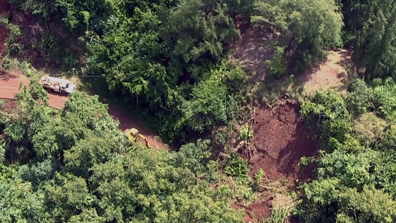
Image above: Only public road along the north shore of Kauai in Waikoko is obliterated by landslide west of Hanalei Bay.  Click to enlarge. Still image from video below.

Living in Kauai on the south side of Kauai we have missed he destruction of storms that destroyed much of the communities and infrastructure on our north shore. The impact has been tremendous for residence there; homes destroyed and roads wiped away.

As much suffering as this has caused and the long term difficulties that will linger, there is a thin silver lining in the darkened clouds.
 
The army of tourists in rented cars making the obligatory daily pilgrimage to Kee Beach crowding the roads, overflowing the parking lots and trampling the land has been temporarily halted.

When the roads are repaired and northshore tourism resumes we hope it is under new circumstances that would restrict tourist cars from anywhere west of Hanalei Bay. There was a feeble attempt to due this in the recent pass, but the will to disappoint tourists simply collapsed.

Here on the south shore we have noticed traffic through Hanapepe has increased significantly since last spring. Some of this is due to more rush hour traffic, presumably from the GMO companies and the PMRF (Pacific Missile Range Facility). We have a regular weekday 3pm eastbound rush hour never seen before.

Moreover, our local county beach, Salt Pond Beach Park, has been overrun by tourists since for over six months. This is certainly been in part because of the destruction of subtropical vacation destinations in the Caribbean.

In the last hurricane season there were 5 category-five storms that destroyed beaches, resorts, roads and much of amenities that attracted visitors. Puerto Rico is still suffering from island-wide blacked-outs. And here comes another hurricane season.

There seems to have been a bit of a campaign to make Salt Pond a heavier used visitor destination as well. Salt Pond is now rated online as a top beach for tourists. This take may take some pressure of totally overrun Poipu Beach Park and other crowded locations, but it is has unanticipated effects.

Salt Pond has historically been a "local" beach used as an outdoor living/rec room for many local families from the westside. Birthdays, weddings, graduation parties, spear-fishing surf-casting, BBQs and minding the kids and just kicking back with a beer after work has been the usage.

There is also and tradition of people temporarily living in tents (mixed with tourist camping) that helps transition (some people I've known) through a job loss, breakup or other temporary difficulty.

Anyway, I continue to hope jet plane enabled mass tourism to Hawaii ceases for two primary reasons. Is is destroying Kauai and it is destroying the atmosphere.

I have not flown to the mainland in several years and have no plans to start again.


Video above: Hawaii Department of Land & Natural Resources damage assessment of storm damage on several videos of the North Shore of Kauai. For more videos visit Vimeo site (https://vimeo.com/265509802).

.