Showing posts with label Big Island. Show all posts

Hawaiians fight Mauna Kea telescope

SUBHEAD: Native Hawaiians say "If not now, when will we stand to protect our sacred lands?" 

By Amy Goodman on 22 July 2019 for Democracy Now!-
(https://www.democracynow.org/2019/7/22/mauna_kea_thirty_meter_telescope_resistance#transcript)


Image above: From the Honolulu newspaper The Star labeled "Hawaiian activists prepare convoys ton convoys to proposed telescope site. From (https://images.thestar.com/nOL4rf4iZSFiR1QqCmEx-tahjR8=/1086x869/smart/filters:cb(1563118201053)/https://www.thestar.com/content/dam/thestar/news/world/us/2019/07/14/hawaiian-activists-prepare-for-mauna-kea-telescope-convoys/HIHIO301-413_2018_164051.jpg).

A historic indigenous resistance is unfolding on the Big Island of Hawaii, where thousands have descended on Mauna Kea, a sacred Native site, to defend it from the construction of a $1.4 billion telescope.

Scientists say the Thirty Meter Telescope will help them peer into the deepest corners of space, but indigenous resisters say the construction was approved without their consent and will desecrate their sacred lands.

Last week, police arrested 33 people — most of them Hawaiian elders — as they blocked a road to prevent work crews from reaching the site of the telescope being planned atop Mauna Kea.

And on Sunday, demonstrators reported that more than 2,000 people had gathered at the access road to stop construction. We speak with Pua Case, an indigenous organizer and activist defending Hawaii’s Mauna Kea.

TRANSCRIPT

AMY GOODMAN: The Filipino-Hawaiian musician Kalani Pe’a, who’s been at the protests that we’ll be talking about now. This is Democracy Now!

I’m Amy Goodman, as we go to Hawaii’s Big Island, where growing protests are heading into a second week against the construction of a massive telescope on top of Mauna Kea, a dormant volcano, sacred Native site, that’s become a flashpoint of indigenous resistance.

On Sunday, demonstrators reported more than 2,000 people had gathered at an access road to stop construction on Hawaii’s highest peak from starting.

Last week, police arrested 33 people, most of them Hawaiian elders, as they blocked a road to prevent work crews from reaching the site of the Thirty Meter Telescope being planned atop Mauna Kea.
HAWAIIAN ELDER: We have a right to worship god in the environment of our belief. Respect it!
AMY GOODMAN: Just hours after the arrests, Hawaii’s Democratic Governor David Ige signed an emergency order granting police more power to clear the way for construction equipment.
GOV. DAVID IGE: This afternoon, I signed an emergency proclamation for the situation on Mauna Kea. Since Monday, protesters have illegally occupied roads and highways. … We do believe that this emergency proclamation gives law enforcement the additional tools that they need to continue to work to keep the people safe.
AMY GOODMAN: Activists say construction of the telescope was approved without consulting the local Native community. The protests build on decades of indigenous resistance in Hawaii. This week, the Hawaii County Council plans to vote on a resolution, quote, “strongly urging” Governor Ige and Mayor Harry Kim to honor a request for a 60-day moratorium on the construction.

For more, we go to Hawaii’s Big Island, where we’re joined by Pua Case, an indigenous organizer, one of the leading activists defending Hawaii’s Mauna Kea.

Welcome to Democracy Now! It’s great to have you with us, Pua. If you can describe for us where you are and just tell us what is happening? Who is building, or attempting to build, this telescope? And why are the indigenous people of Hawaii so concerned?

PUA CASE: Aloha Mai Kako. ‘O Pua Case ko’u inoa. ‘O Mauna a Wakea ko’u mauna.Aloha, everyone. My name is Pua Case. Mauna Kea is my mountain. I’m reporting from a hunter’s check-in station, at a place called Pu’u Huluhulu, which is right across the street of the access road leading up to Mauna Kea.

Mauna Kea is a sacred mountain for us here in Hawaii. Mauna Kea is genealogically linked to the Native people of these lands. Mauna Kea is known as our kupuna, our ancestor, our teacher, our protector, our corrector and our guide.

And so, for the last 10 years, we have held off the project of the building of an 18-story telescope on the top of our mountain, near the summit, on a pristine area called the northern plateau, over our water aquifer and the source of water for much of this island.
Those who are partnering in this project are Canada, China, India, Japan and the United States in the area of California, with the largest single donor being the Gordon and Betty Moore Foundation in Palo Alto.

So, why we are standing for this mountain is quite simple, Amy. And thank you for having me on the show. If I could put it very simply, I would say, if we don’t stand for the most sacred, what will we stand for? And if not now, when will we stand?

So, we are making a stand as not just Native people and not just the local community, but really a worldwide community, because there are so many similarities. There are Native people everywhere around the world standing for their mountaintops, for their waters, for their land bases, their oceans and their life ways. We are no different than them.

But because Mauna Kea is the highest mountain in the world from seafloor, and, spiritually speaking, there are reasons that Mauna Kea is connected to many different mountains around the world, and the integrity and the essence of water in our spirituality, is why we must not allow 18 stories to be built on the northern plateau of our mountain.

It is the one too many and the one too big. And we have said no for the last 10 years and have been successful so far in stopping the project.

AMY GOODMAN: Now, the foundation gave money to Caltech, is that right, Pua?

PUA CASE: Yes, it is.

AMY GOODMAN: And who was consulted? Why do they have rights to this mountain?
PUA CASE: The university —

AMY GOODMAN: There are other telescopes there, is that right?

PUA CASE: Yes, there are other telescopes on the summit of the mountain. The University of Hawaii has the lease on the summit of the mountain until 2033. So, from the late 1960s, there have been smaller telescopes built on the mountain. And, you know, Amy, you have to understand, and I’m explaining to the world community right now, it would take a whole semester course to try to explain why 13 telescopes are now sitting at the top of the mountain.

What I can say is that for many of our people, my grandparents’ generation and my parents’, as well, you know, there comes — in that time period, you don’t even know if you have the ability to stop something like that. We were in a time period where people would say, “Oh, they’re just going to build it anyway.”

And a lot of times, we were not even aware that building was occurring on the summit. And so, for a lot of different reasons, 13 telescopes sit on the summit of Mauna Kea.

The 18-story Thirty Meter Telescope cannot possibly fit on the mountain. The desecration, the construction and the destruction of the northern plateau is just something that cannot be allowed on our sacred mountain. As I said before, it’s the one too many and the one too big.

So, what I will say is, the University of Hawaii initiated the permit on behalf — the permit application on behalf of the countries, because most of the countries are already up on the mountain in those 13 other telescopes. Only China and India are not on the mountain at this time.

AMY GOODMAN: We heard that the National Guard might be called in. You have the Hawaii governor, David Ige, issuing an emergency order granting police more power to clear the way for construction equipment. He says that the protesters are dangerous. Can you talk about what you expect to happen today? First, I want to go to an activist speaking last week during a news conference.

PUA CASE: Sure.
KAHO’OKAHI KANUHA: And I reaffirm to each and every maka’i, each and every police officer, each and every individual who’s going to come and attempt to get us out of the way, we will stand, and we will stand in Kapu Aloha. We are committed. We are absolutely committed to peace, peaceful protest, nonviolent action. We are not wavering from that. And so, to the maka’i, I ask you folks to make that same commitment, because you guys are not my enemy. None of you are my enemy. Our enemy is this illegal occupying state, that continues to deny the rights of Kanaka, who continue to treat us as a nonexistent, dead people. Eka Lahui, are we dead?
PROTESTERS: A’ole
KAHO’OKAHI KANUHA: Are we dead?
PROTESTERS: A’ole!
KAHO’OKAHI KANUHA: We’re alive.
AMY GOODMAN: That, an activist at a news conference last week. So, talk about the governor’s charges and also where the Honolulu mayor stands.

PUA CASE: That young activist is one of our organizers. That’s Kaho’okahi Kanuha. And his words exemplify the stance that we were taking on the day that the law enforcement came in to the access road area.

And what I want to preference — preface this with is, who would ever think — and that’s what I spoke to the maka’i, or the law enforcement, about as they stood there, some of them in full riot gear with their batons, many of them either our relatives or Native Hawaiians, who are put in a very difficult position to have to stand there and possibly arrest us, and, certainly, the possibility of harm.

So, what I said to them that day was, who would ever think — who would ever think that in Hawaii, I, as a middle school teacher and just the daughter of ranchers that come from this area — and many of us, you know, we are just — we are mothers and fathers. We are aunties and uncles. We are elders, and we are youth.

And being so passionate about what is left of our culture, our sacred places and our life ways — that we would find ourselves standing in the middle of the street facing armed officers with only our Kapu Aloha, or the manner in which we stand, our code of conduct, integrity, standing in the way that our ancestors would expect and command of us, in nonviolence, no resistance, facing our relatives. And so that that in itself is very difficult.

So, Governor Ige, our governor, did issue a state of emergency at the end of that day, after 33 of our elders were arrested because they had made a stand, and they are still sitting in those chairs ’til today, make a stand to block that access road, because that is the only way that the machinery will be able to go up the mountain. So, what I want to —

AMY GOODMAN: Pua, I wanted to —

PUA CASE: — have — yes?

AMY GOODMAN: I wanted to read from the Honolulu Star-Advertiser, the local paper.
PUA CASE: Sure.

AMY GOODMAN: It says, “The Gordon and Betty Moore Foundation in 2007 committed $200 million to the California Institute of Technology and the University of California toward TMT’s construction. Gordon Moore is a leader in the semiconductor industry and co-founder of Intel Corp., creator of the world’s first microprocessor.”

You have what happened yesterday at Standing Rock, the Standing Rock Sioux tribal members gathering at the epicenter of the Dakota Access pipeline to show solidarity with you, with Native Hawaiians, who are opposing the construction of this huge telescope at Mauna Kea. Can you compare what’s happening right now to what took place in Standing Rock? Do you see similarities?

PUA CASE: You know, I certainly can, because I was at Standing Rock twice. And so were a large number of our people here. When Standing Rock occurred, we already had a relationship with the leadership of both Sacred Stone Camp and Standing Rock. And, in fact, the first day, when we took that stance, when the elders sat there and chose to block the road, the first caller that we had that morning to bless our day was LaDonna Brave Bull Allard.

So, we have a very close relationship to our relatives, because we are both standing for what is sacred: water. We are standing for the water from our mountain, and they, of course, are standing for their water.

The similarities are astounding, some of them being you have a small space with a large amount of people that cannot help themselves but be there, because for those of us who are either struggling, who have lost so much, when we see the opportunity to assist and support relatives who are going through the same thing, we will do everything in our power to either be there or assist in some way from afar.

So, many, many of our relatives from Standing Rock have pledged to be here, if we put the call out. So, the camaraderie, the alliances, the networking and the relationships that you create when you stand on each other’s front lines is something that is binding. We make a commitment to each other.

Right now we have not put out that call, because we went from 30 people, when we started last Friday — we are up to about 3,000 people. So, at this point, we have not put a call out to anyone anywhere other than Hawaii. However, we are finding each day that relatives from all around the world are finding their way here, even though that call out has not been made.

AMY GOODMAN: And do you expect the National Guard to come out today?

PUA CASE: The National Guard is here, yes. When Governor Ige did issue the state of emergency that allowed for the deployment of the National Guard, we know that they have been flying in. We know that they are housed very close to where we are, because the Pohakuloa military base is just miles down the road.

I can’t tell you what will happen today, to be quite honest. It changes every second of the day. I’m not sure we are aware of what is going to happen. We just remain on alert. We remain vigilant, 24 hours.
We are actually located in a parking lot, which has become a sanctioned sanctuary and safe place for us, and along the sides of a road in lava fields.

So, that’s where we differ from Standing Rock. We don’t have the kind of infrastructure here to create a large camp, except to be right in the elements, in the lava, and in the parking lot across from the access road.

We know that the National Guard is here. We know that a large amount of law enforcement is here, as well. And again, I have to emphasize that we are people, just people. We are not trained. We are not armed. We come from all walks of life. We are Native people. We are local residents. We are visitors. But we have made a commitment.So, what I would like to share, just as an example of how it is here —

AMY GOODMAN: We just have 30 seconds, Pua.

PUA CASE: Oh, I’m sorry. So, what I would like to say, in ending, if we have 30 seconds left, is I want to thank the worldwide community for standing with us. And so, what we are asking is that you go to Actions for Mauna Kea Facebook page.

You can find all the information about us. Thank you to everyone around the world, and to you, Amy, for allowing us to voice what is happening here in Hawaii. We are proud people. We are standing for what we have left. And —

AMY GOODMAN: Pua —

PUA CASE: Mahalo.

AMY GOODMAN: Pua, I want to say thank you for joining us. I’d like to ask you to stay to the top of the hour to do Part 2 of this interview, where you can explain further why you are taking this stand. I want to thank you, Pua Case, indigenous organizer defending Hawaii’s Mauna Kea.

She is there at the access road with so many others, who are trying to prevent the Thirty Meter Telescope, or TMT, from being built at the summit of Mauna Kea, the largest mountain in the world, a volcano. Thank you so much for being with us from Hawaii.

See also:
Mauna Kea telescope protest - Ea O Ka Aina 2 April 2014
Ige listens to Hawaii - Ea O Ka Aina 8 April 2015
Education and the Mountain - Ea O Ka Aina 15 April 2015
Eight arrested on Mauna Kea - Ea O Ka Aina 10 September 2015
No permit for TMT on Mauna Kea - Ea O Ka Aina 3 December 2015

.

USGS info on Kilauea Volcano

SUBHEAD: How much danger is there of massive tsunami caused by collapse of East Rift Zone area?

By Staff on 28 June 2018 for United States Geological Survey -
(https://volcanoes.usgs.gov/observatories/hvo/)


Image above: Photo from south of Puna as Kilauea volcano lava enters Pacific Ocean causing clouds of steam and vog. From (https://www.inverse.com/article/46466-kilauea-volcano-ocean-entry-deemed-hazardous-as-dangerous-laze-persists).

[IB Publisher's note: There is a wide range of opinions about the danger imposed by current volcanic activity on the Big Island of Hawaii. Some fear the risks are being minimized to keep people calm and not scare tourists away. Some even fear a catastrophe of biblical proportions is imminent. Below are recent reports by the United States Geological Survey. They may be hiding the truth to allay a panic. But they, more than any other source, have the real data. Here are some of their recent reports to the public.]

Answers to Questions about Kīlauea Volcano's earthquakes
June 28, 2018

The summit area of Kīlauea Volcano has undergone significant changes since April 2018. On April 21, the lava lake within Halema‘uma‘u overflowed onto the crater floor as the volcano's magmatic system pressurized.

On April 30, the floor of the Pu‘u ‘Ō‘ō crater collapsed, as subsurface pressure forced open a pathway for magma to travel from Pu‘u ‘Ō‘ō into the lower East Rift Zone. As magma moved into the lower East Rift Zone, pressure decreased in the summit's magmatic system and the lava lake level began to drop. The summit also started to deflate due to the pressure decrease.

As summit deflation (or subsidence) persisted, the number of earthquakes increased. Prior to the onset of deflation, about 10 earthquakes per day were typical at the summit. As of late June 2018, there are about 600 earthquakes located in the same region on a daily basis. Many of these earthquakes are strong enough to be felt, and some can be damaging.

These earthquakes are understandably causing concern, especially in Volcano Village and surrounding subdivisions. These Frequently Asked Questions about Kīlauea Volcano's Summit Earthquakes will help answer some of the most commonly asked questions about the nature of Kīlauea's summit activity, and the numerous earthquakes that are occurring in the area.


Saying "goodbye" to one GPS station and "hello" to two more
June 25, 2018

On June 18, Hawaiian Volcano Observatory staff said a sad goodbye to a GPS instrument that had faithfully recorded over 95 m (310 ft) of downward motion of the floor of Kīlauea caldera before losing radio contact. The GPS instrument, called NPIT, first started moving downward in early May at the onset of subsidence at Kīlauea's summit.

However on June 8, NPIT's motion picked up dramatically. This was when a portion of the caldera floor north of Halema'uma'u, where NPIT was located, began to slump into the crater. Over the next ten days NPIT GPS recorded down-dropping of 6-8 m (20-25 ft) with each summit explosion event, which have been occurring almost every day.

This, together with earlier displacements, added up to a position change of 95 m down, 55 m south, and 5 m east (310 ft, 180 ft, and 16 ft, respectively).

These data provide unique insight into the crater collapse process, showing us that it is occurring as a series of steps instead of as continuous motion. Drone and helicopter views confirm that NPIT is still intact and likely still recording data.

Unfortunately, the large motions have now resulted in a misalignment of the radio shot between the instrument and the observatory, cutting off communication and therefore data flow from the GPS station.

At about the same time that we lost the ability to contact NPIT, HVO staff completed work to add telemetry to two temporary GPS stations on the caldera floor.

These two stations, called CALS and VO46, are not located on actively slumping portions of the caldera floor and therefore do not show the dramatic downward motion that NPIT did.

However, they reveal that even portions of the caldera floor away from active slumping are moving downward very quickly; by as much as 1.0 m per day (3.3 feet per day) at station CALS. The data from these new stations can be viewed on the deformation page for Kīlauea.


Why so many earthquakes in the Kīlauea summit area?
May 29, 2018

Deflation at Kīlauea's summit has caused up to 1.5 meters (about 5 feet) of subsidence, which has stressed the faults around and within Kīlauea Caldera. Read more


GPS monitoring reveal where magma has moved
May 24, 2018

Kīlauea Volcano is currently erupting at two locations: from Halema‘uma‘u, a crater within the summit caldera, and from the lower East Rift Zone (LERZ) in and near the Leilani Estates and Lanipuna subdivisions.

Small explosive episodes at Kīlauea's summit are a consequence of magma withdrawing from a shallow reservoir beneath the east margin of Halema‘uma‘u. The eruption of lava along the LERZ resulted from the underground movement of magma eastward from the volcano's middle East Rift Zone.


Image above: Illustration of Kīlauea Volcano from the summit caldera to the lower East Rift Zone (LERZ). Blue arrows = contraction across the upper and middle rift zone, black arrows = expansion in LERZ. From original article.

GPS, tiltmeters, and satellite radar (InSAR) data captured how Kīlauea's surface has moved since the Pu‘u ‘Ō‘ō vent collapsed on April 30, 2018. These data allow scientists to infer where magma was removed and the location to which it was transferred. In the first days following the collapse of Pu‘u ‘Ō‘ō, the largest signals indicated contraction across the upper and middle East Rift Zone—evidence that magma was being withdrawn from this area.

This was followed by expansion across the LERZ—evidence that magma was intruding into this part of the rift zone at depths of less than about 3 km (2 mi). The forceful widening of the LERZ continued through May 18, at which time a GPS site north of the intrusion stopped moving northwestward and stabilized.

In early May, days after the collapse of Pu‘u ‘Ō‘ō, the lava lake level in Halema‘uma‘u began to drop as the summit area subsided at a high rate. The lava lake surface disappeared from view on about May 10, at a depth of more than 325 m (1,070 ft) below the Halema‘uma‘u crater floor.


Image above: This plot shows vertical displacement of a USGS GPS (CRIM) station from April 26 to May 24, 2018. From original article.

Subsidence of the summit area continues. Between May 1 and May 24 the caldera floor subsided as much as 1.4 m (4.5 ft). The GPS station, labeled as CRIM on the edge of Kīlauea's summit caldera [Fig.2], has subsided about 0.6 m (1.9 ft).

Continued summit subsidence indicates that magma is moving from the summit magma reservoir and into the East Rift Zone at a higher rate than magma is entering the reservoir from below. To date, geochemical analysis of erupted lava indicates that summit magma has not yet erupted from the LERZ fissures 1-23.


Facts on stability of Kīlauea's south flank, past and present
 May 14, 2018

There have been several recent highly speculative stories, rumors and blogs about the stability of the south flank of Kīlauea and the potential for a catastrophic collapse that could generate a Pacific-wide tsunami. We wish to put these speculations in their proper context by presenting observations of the current situation and an assessment of past evidence of landslides from Kīlauea.

There is no geologic evidence for past catastrophic collapses of Kīlauea Volcano that would lead to a major Pacific tsunami, and such an event is extremely unlikely in the future based on monitoring of surface deformation. Kīlauea tends to "slump", which is a slower type of movement that is not associated with tsunamis, although localized tsunamis only affecting the island have been generated by strong earthquakes in the past.

The May 4 M6.9 earthquake resulted in seaward motion of approximately 0.5 m (1.5 ft) along portions of Kīlauea's south flank as measured by GPS stations across the volcano.

A preliminary model suggests that the motion was caused by up to 2.5 meters (8 feet) of slip along the fault that underlies the volcano's south flank, at the interface between the volcano and the ocean floor, about 7-9 km (4-6 mi) beneath the surface.

This motion is within the expected range for a large earthquake on this fault. The earthquake was probably caused by pressure exerted by the magmatic intrusion on the south flank fault, following the pattern of past earthquake activity that has been observed during Kīlauea East Rift Zone intrusions.

A small, very localized tsunami did occur as a result of the fault slip. Similar local tsunamis were generated by past large earthquakes, including the 1975 M7.7 and 1868 ~M8 events, both of which resulted in multiple deaths along the south coast of the Island of Hawai‘i.

Adjustments on the south flank caused another ~9 cm (3.5 inches) of motion at the surface in the day after the earthquake, followed by another 2-3 cm (~1 inch) since May 5.

This is higher than the normal rate of south flank motion (~8 cm (3 inches) per year) but is expected as the volcano adjusts after a combination of a magmatic intrusion along the East Rift Zone and a large south flank earthquake.

We did observe minor ground ruptures on the south flank, but this is expected given the strength of the May 4 earthquake, and deformation data show that the south flank continues to move as an intact slump block.

Geologic history combined with models of south flank motion suggest that the likelihood of a catastrophic failure event is incredibly remote. There are certainly signs on the ocean floor for landslides from other volcanoes on the Island of Hawai‘i and from other islands, but none are associated with Kīlauea.

In addition, Kīlauea has experienced much larger earthquakes and magmatic intrusions in the recent past. The large earthquakes of 1975 and 1868 were not associated with significant south flank landsliding, nor were major East Rift Zone intrusions in 1840 and 1924.


Image above: This plot shows vertical displacement of a USGS GPS (CRIM) station from April 26 to May 24, 2018. Cross-section through the lower East Rift Zone of Kīlauea Volcano. From original article.

Cross-section through the lower East Rift Zone of Kīlauea Volcano. Magma intruded into the rift zone and exerted pressure on the south flank of Kīlauea, likely encouraging the M6.9 earthquake that occurred on a fault located at the interface between the volcano and the preexisting ocean floor.

.

Kilauea Volcano Update

SUBHEAD: Earthquake rocks Hawaii volcano and lava destroys Hawaii County Mayor Kim's home.

By John Bacon on 5 June 2018 for  USA Today -
(https://www.usatoday.com/story/news/nation/2018/06/05/hawaii-volcano-earthquake-rattles-kilauea-spewing-ash-mile-high/672222002/)


Image above: Kilauea volcano Lava pours into the Pacific Ocean in the Puna district of the Big Island in Hawaii. From original article. Photo by the USGS.

[IB Publisher's note: Fracking causes earthquakes in places that are not prone to them. We are mostly aware of fracking used to work seams of underground fossil fuels. But it should be noted that the large geothermal energy effort that supplies 25% of the electrical energy used on the Big Island employs fracking technology deep underground in several "wells" where the volcanic activity is in the Kilauea area of Puna.] 

A magnitude-5.5 earthquake rattled Hawaii's Kilauea volcano Tuesday as the home of Hawaii County Mayor Harry Kim was added to the inventory of destruction wrought by the searing lava ushering havoc into nearby Big Island communities.

Kim's home in the Vacationland neighborhood is one of 117 confirmed burned in the area since Kilauea began erupting May. 3. Authorities say the true number is much higher.

“Harry had a premonition this was going to happen,” Janet Snyder, spokeswoman of the Hawaii County Civil Defense, told the Honolulu Star-Advertiser. “Vacationland is almost totally destroyed."

Tuesday's quake, the latest in a series to rock the surging volcano, spewed ash a mile into into the air. Some areas may have experienced "strong shaking," but no tsunami was triggered, the Pacific Tsunami Warning Center said.

Lava is entering the water at the Vacationland tidepools and has inundated most of the subdivision, the Hawaii Volcano Observatory reported after a flyover Tuesday. To the north, lava has covered all but the northern part of lots in Kapoho Beach, the observatory said.

Thousands of residents of the Big Island's Puna district have evacuated since the eruptions began. Residents of Leilani Estates were ordered out weeks ago, and Kapoho Beach and Vacationland were recently evacuated amid fears that residents would be unreachable for rescue teams.

Most of Hawaii Volcanoes National Park remains closed because of a series of damaging earthquakes, corrosive volcanic ash and continuing explosions from Halema‘uma‘u, the summit crater of Kilauea.

“Unlike lava, which you can see coming and avoid, we cannot see or predict earthquakes," Park Superintendent Cindy Orlando said. "Nor can we foresee a summit explosion. But both threats continue."

The area also is seeing increasing damage to its natural beauty. Kapoho Bay, near the Big Island's eastern tip, was filled with lava extending almost three-quarters of a mile from shore, the U.S. Geological Survey said in a statement. That raises the threat from laze, a toxic mixture of hydrochloric acid formed by lava vaporizing seawater.

At the Malama Kī Forest Reserve, forest managers report that up to half the 1,514 acres have thus far been "impacted" by the eruptions. The forest has served as habitat to sub-populations of native birds including Hawaiian honeycreepers, the Hawai‘i 'amakihi and ‘apapane.

The loss of forest habitat because of lava inundation and defoliation could mean these "sub-populations of wildlife may no longer persist, rapidly decline or become further fragmented and/or contract in range," forestry official Steve Bergfeld warned.

In the Puʻu Makaʻala Natural Area Reserve, higher up on the slopes of Kilauea, staff involved in the recovery of the endangered Hawaiian crow, the ‘alala, were closely monitoring birds released in the area.

"Staff on-site in the release area are prepared to recapture birds and transport them if needed,” project manager Jackie Levita-Gaudioso said.


Big Island Geothermal
SUBHEAD: Israeli-owned geothermal plant in Hawaii under fire as lava oozes nearby.

By Staff on 23 May 2018 for  Associated Press - 
(https://www.timesofisrael.com/israeli-owned-geothermal-plant-in-hawaii-under-fire-as-lava-oozes-nearby/)


Image above: Lava approaches Ormat's Puna Geothermal Venture plant on Hawaii's Big Island on May 21, 2018. Photo by Mario Tama. From original article.

Workers scramble to shut vents at Ormat Technology's Puna facility after Kilauea eruption claims adjacent building; stocks tumble in Tel Aviv and New York.

Authorities were racing Tuesday to close off production wells at an Israeli-owned geothermal plant threatened by a lava flow from Kilauea volcano on Hawaii’s Big Island.

Workers were capping the 11th and last well at the plant to prevent toxic gases from wafting out after lava entered, then stalled, on the property near one of the new volcanic vents.

“Right now, they’re in a safe state,” Mike Kaleikini, senior director of Hawaii affairs for the Puna Geothermal Venture plant, said of the wells. There also were plans to install metal plugs in the wells as an additional stopgap measure.

The wells run as far as 8,000 feet (2,438 meters) underground at the plant, which covers around 40 acres (16 hectares) of the 815-acre (329.8 hectare) property. The plant has capacity to produce 38 megawatts of electricity, providing roughly one-quarter of the Big Island’s daily energy demand.

Lava destroyed a building near the plant, bringing the total number of structures destroyed in the past several weeks to nearly 50, including dozens of homes.

The latest was a warehouse adjacent to the Puna plant, overtaken by lava on Monday night, Hawaii County spokeswoman Janet Snyder told the Honolulu Star-Advertiser. The building was owned by the state of Hawaii, and was used in geothermal research projects in the early days of the site.

Puna Geothermal, owned by Ormat Technologies, was shut down shortly after Kilauea began spewing lava on May 3. The plant harnesses heat and steam from the earth’s core to spin turbines to generate power. A flammable gas called pentane is used as part of the process, though officials earlier this month removed 50,000 gallons (190,000 liters) of the gas from the plant to reduce the chance of explosions.

Founded in Yavne, Israel, Ormat is today headquartered in Nevada. Its main manufacturing facilities remain in Israel.

Native Hawaiians have long expressed frustration with the plant since it came online in 1989; they believe is built on sacred land. Goddess of fire, Pele, is believed to live on Kilauea volcano, and the plant itself is thought to desecrate her name. Other residents have voiced concerns over health and safety.

Scientists, however, say the conditions on Kilauea make it a good site for harnessing the earth for renewable energy.

“There’s heat beneath the ground if you dig deep enough everywhere,” said Laura Wisland, a senior analyst at the Union of Concerned Scientists. But in some places in the U.S. “it’s just hotter, and you can access the geothermal energy more easily.”

Geothermal energy is also considered a clean resource as it doesn’t generate greenhouse gas emissions, said Bridget Ayling, the director of Nevada’s Great Basin Center for Geothermal Energy.

Ormat said in a May 15 statement that there was a low risk of surface lava making its way to the facility. The company also said there was no damage to the facilities above-ground and that it was continuing to assess the impact. The plant is expected to begin operating “as soon as it is safe to do so,” according to the statement.

Puna Geothermal represents about 4.5 percent of Ormat’s worldwide generating capacity. Last year, the Hawaii plant generated about $11 million of net income for the company. Ormat is traded on the New York and Tel Aviv stock exchange, and shares have fallen nearly 10 percent since Kilauea began erupting.

Scientists say lava from Kilauea is causing explosions as it enters the ocean, which can look like fireworks. When lava hits the sea and cools, it breaks apart and sends fragments flying into the air, which could land on boats in the water, said US Geological Survey scientist Wendy Stovall.

Kilauea sparked new safety warnings on Monday about toxic gas on the Big Island’s southern coastline after lava flowing into the ocean set off a chemical reaction. Large steam plumes created lava haze, or “laze,” laced with hydrochloric acid and fine glass shards when it flowed into the sea.

It’s just the latest hazard from a weeks-old eruption that has so far generated earthquakes and featured gushing molten rock, giant ash plumes and sulfur dioxide. There has been continuous low-level ash emission from Kilauea’s summit with larger explosions every few hours, said U.S. Geological Survey geophysicist Mike Poland.

See also:
University of Hawaii animated Vog Map daily-hourly
Ea O Ka Aina: Kilauea Volcano 5/4/18
EA O Ka Aina: Volcanoes - Hawaii & Iceland 4/20/10

.

Kilauea Volcano

SUBHEAD: USGS says earthquakes and lava fissures could last for months on the Big Island of Hawaii.

By Karin Stranton on 4 May 2018 for Reuters -
(https://www.reuters.com/article/us-hawaii-volcano/earthquakes-lava-fissures-could-last-for-months-on-hawaii-usgs-idUSKBN1I608N)


Image above: Lava advances along a street near a fissure in Leilani Estates, on Kilauea Volcano's lower East Rift Zone, Hawaii, the U.S., May 5, 2018. From original article.

More homes on Hawaii’s Big Island were destroyed on Saturday as eruptions linked to the Kilauea volcano increased, spewing lava into residential areas and forcing nearly 2,000 people to evacuate, officials said.

Scientists forecast more eruptions and more earthquakes, perhaps for months to come, after the southeast corner of the island was rocked by a 6.9 tremor on Friday, the strongest on the island since 1975.

The U.S. Geological Survey (USGS) said on Saturday that several new lava fissures had opened in the Leilani Estates subdivision of Puna District, about a dozen miles (19 km) from the volcano. Not all the fissures were still active, it added.

The Hawaiian Volcano Observatory said at midday local time on Saturday that “eruptive activity is increasing and is expected to continue.”

Janet Babb, a spokeswoman for the observatory, said by telephone that the eruptions could carry on “for weeks or months.”

Babb said the activity since Thursday is beginning to show similarities to another event in the area in 1955 that lasted for 88 days, when far fewer people lived near the volcano.

Although no significant lava flows have yet formed, additional outbreaks of lava, which can reach temperatures of about 2,100 degrees Fahrenheit (1,150 Celsius), were expected, the Hawaii County Civil Defense Agency said.

The Hawaii Fire Department reported “extremely dangerous air quality conditions due to high levels of sulfur dioxide gas in the evacuation area,” civil defense officials said on Saturday. The gas can cause skin irritations and breathing difficulties.

Ken Smith of Mountain View on the island ran errands on Friday evening on streets usually busy with pre-weekend traffic, “but the roads were totally empty,” he said by telephone. “It felt almost apocalyptic.”

Kilauea, one of the world’s most active volcanoes and one of five on the island, has been in constant eruption for 35 years. Lava flows from the volcano have covered 48 square miles (125 square km), according to the USGS.

Kilauea began spewing lava into residential areas on Thursday after a series of earthquakes over the preceding week. Starting around 11 a.m. on Friday, the island experienced a flurry of earthquakes, culminating in the massive magnitude 6.9 tremor.

No injuries or deaths were reported, but Hawaii Governor David Ige activated the Hawaii National Guard to provide emergency help.

U.S. Representative Tulsi Gabbard of Hawaii called on federal officials to send help quickly.

Gabbard, a Democrat, in a letter sent Friday, asked Federal Emergency Management Agency Administrator William Long to respond to “short- and long-term housing, infrastructure, agriculture, and public health effects to Hawaii Island.”

Gabbard said more than 1,800 residents in Leilani Estates and Lanipuna Gardens have been ordered to leave their homes since Thursday, when public works officials first reported steam and lava erupting from fissures in a road.

.

Effort to de-occupy Hawaii

SUBHEAD: "E Ho'Olokahi Ka Lahui" "A Call to Make the Nation as One"

By Walter Ritte on 25 June 2017 in Island Breath -
(http://islandbreath.blogspot.com/2017/06/effort-to-de-occupy-hawaii.html)

http://www.islandbreath.org/2017Year/06/170625kalahuibig.jpg
Image above: Poster/Schedule for E Hoʻolokahi Ka Lahui events featuring royals who lead Hawaii during its independence. Click to enlarge.

I’d like to invite you to a series of free La Ho'i Ho'i Ea (Sovereignty Restoration Day) events in July! Celebrate with the community and learn about the legal steps being taken to de-occupy Hawaii.

The E Hoʻolokahi Ka Lahui events are being held on each of the Islands in conjunction with the sovereignty month of La Hoʻi Hoʻi Ea and will feature speakers, films, music and local food.

Our goal is to bring attention to the fight for an independent and sustainable Hawaii. We want to lokahi around the effort to de-occupy Hawaii at the Peace Palace at the Hague in the Netherlands and educate the international community of the truth of who we are.

Food independence remains a crucial problem for Hawaii – the event series is our opportunity to discuss this and other issues with our community while celebrating the beauty and perseverance of our islands and people.

WHEN & WHERE:
July 1 – Molokai, Kaunakakai library, 5-9 PM
July 8 – Kauai, Kauai Community College, 11 AM-4 PM
July 15 – Big Island, Kona location TBA
July 22 – Big Island, Uncle Roberts Aha Bar in Kaimu 4-9 PM
July 23 – Maui, location TBA
July 29 – Oahu, location TBA

Check back often for updates on the HCFS Facebook page >>

We hope to see you there.


.

"Hawaii's Fresh" milk poisons

SUBHEAD: No headlines until recent storms sent tsunamis of dairy sewage racing through Ookala, HI.

By Koohan Paik on 12 April 2017 in Island Breath -
(http://islandbreath.blogspot.com/2017/04/hawaiis-fresh-milk-poisons.html)


Image above: Dead cows ended up in stream runoff with mud and feces on the way to the ocean. From video below.

For years, Ookala residents have been putting up with the sickening pilau caused by Big Island Dairy mauka of the village.

No wonder it smells so rotten; the dairy confines a concentration of 1,800 cows (and growing) that stand and sleep in their own feces. If the cull rate compares to other industrial dairies, it would be about 30 percent per year, and the carcasses are thrown in a nearby pit that is in the path of stormwater runoff.

But the grumbling of Ookala residents didn’t make headlines until recent storms sent tsunamis of dairy sewage racing through their neighborhoods.

At a community meeting on March 28, one man lamented medical bills totaling tens of thousands of dollars for family members who had become sick after their home was marinated in fecal wastewater.

Several water-quality tests in early March taken from Ookala stream (when both dry and after a rain) showed, in all but one sample, that levels of enterococci tallied in at over 2,000 colony-forming units/mL, dangerously exceeding the maximum limit of 130/mL. Residents can’t safely fish or pick opihi with this toxic water flowing into the ocean.

No measurements were taken for antibiotics or hormones carried by the excrement, but, considering the source, high levels would be no surprise.

Most shocking has been Gov. David Ige’s lack of enforcement to protect us. Is this yet another instance of our elected officials colluding with big business?

Yes, it seems that Ige is putting agribusiness before health, safety and local livelihoods. For example, in 2014, the state joined Meadow Gold processing on Oahu to aggressively push dairies to lower the minimum price at which they could sell milk to Meadow Gold. Everyone knew a price drop would send local dairies belly-up.

That tragedy befell Ed Boteilho, whose family had run Cloverleaf Dairy in Hawi for over a half-century. It also prevented Dutch artisanal cheesemaker Kees Kea from achieving his dream of providing quality European cheeses to Hawaii.

Why? Because the only dairies that could afford to operate were the high-volume mega-dairies owned by mainland entities. The sole survivor of the price drop is Big Island Dairy, owned by Steve Whitesides of Idaho, where he owns another mega-dairy comprised of 14,000 cows.

What a difference a price makes. By signing the lowered milk price into law, the future of Hamakua as Oahu’s industrial dairy zone was sealed. Small-scale, local, environmental dairies are now unviable – unless the higher milk price can be restored.

Given this profit-before-people-agenda, it is no surprise that no environmental assessment (EA) was conducted for Big Island Dairy, the largest industrial dairy to ever operate in Hawaii.

And now that the dairy is building its own processing plant (which would cut Meadow Gold out of the chain), there are no plans for an EIS. But there should be.

 The processing plant, which leases land from the state, would produce far more toxic wastewater than what is currently released. If they can’t manage the havoc they are already wreaking, who gave them the green light to make more pilikia?

Big Island Dairy is in Hawaii to exploit. With the compliance of Ige, this bad neighbor has driven local farmers out of business; it has driven pathogen levels in our streams through the roof; it has carpeted our pastures with controversial GMO corn; and, to add insult to injury, it is expanding.

This is the kind of irresponsible ag that turns beautiful lands into rural slums. This is not what we want for Hamakua.


Video above: This film reveals some of what goes on with a large scale industrial milking operation and illustrates why Kauai does not want one in Mahaulepu.  From (https://youtu.be/cOgGjSG8d_I).

See also:
Ea O Ka Aina: Hawaii Dairy Farm permits revoked 2/25/17
Ea O Ka Aina: Out to Pasture 6/2/16
Ea O Ka Aina: Mahaulepu Dairy Farm draft EIS 5/28/16
Ea O Ka Aina: Hawaii Dairy Farm faces lawsuit 6/3/15
Ea O Ka Aina: Hawaii Dairy Farm Factsheet 10/11/14
Ea O Ka Aina: Kauai Grassfed Dairy Fraud 4/13/14
.

Introduction to Hawaiian Land Areas

SUBHEAD: This is a synthesis of the Hawaiian historical record combined with contemporary ecological frameworks.

By Juan Wilson & Jonathan Jay on 2 May 2016 for Island Breath-
(http://islandbreath.blogspot.com/2016/05/introduction-to-hawaiian-land-areas.html)


http://www.islandbreath.org/hawaiinei/M8Niihau/M8NiihauRasterFile.png

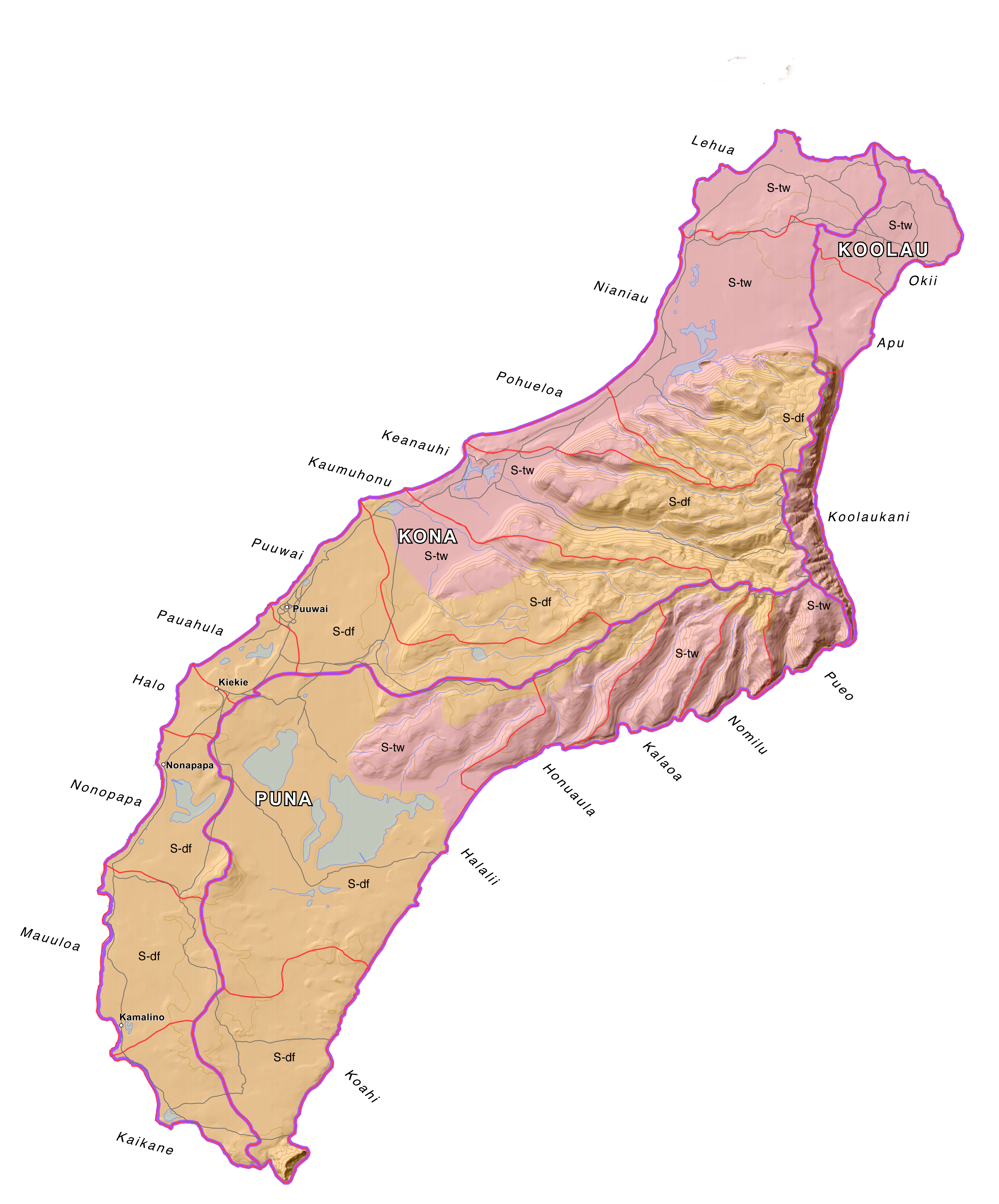
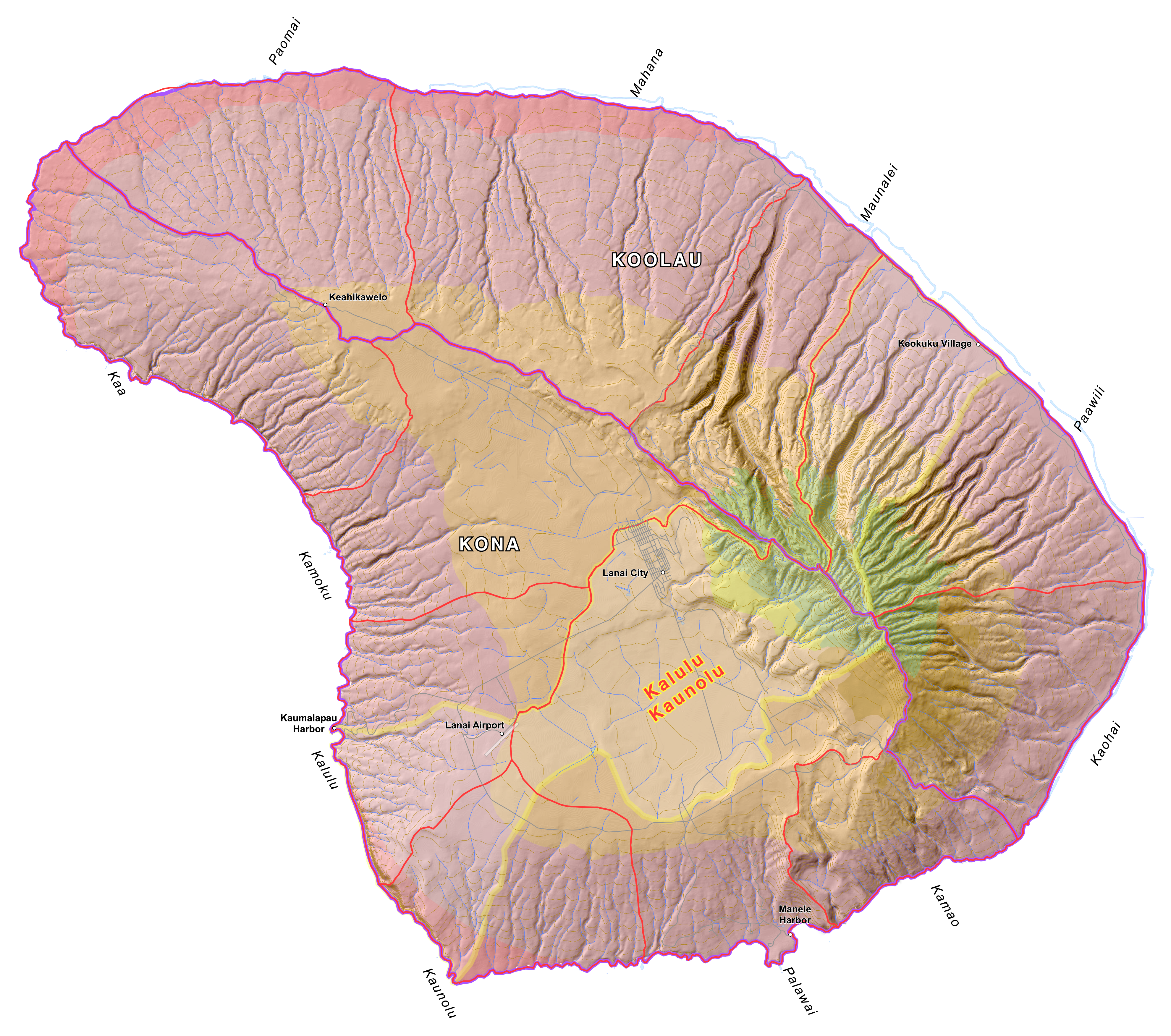
Image above: Map of Niihau, Hawaii, showing Life Zones, Ahupuaa and Moku. Click to enlarge.

By Juan Wilson
The traditional land divisions of pre-contact Hawaiians was based on the sustainability and self-reliance within community watershed areas (ahupuaa) as well as within bioregions (moku) and lastly individual sovereign islands (mokupuni). These natural land divisions were the result of the flow of water over the land.

We are now beginning to include evidence of the flow of water over and under the surface of the islands. We are calling these areas of consideration Waihona.

For simplicity and efficiency this current work is not being coordinated through the Ahu Moku Committee. Historic documents, reference material and selected kapuna are being consulted. On May 1st 2016 we released the current state of the work to the public.

We welcome comment and criticism. This work is far from complete. Waihona are only partially covered at this time.

The new work can be found by clicking here:
(http://www.islandbreath.org/hawaiinei/hawaiinei.html

The available downloadable files of Big Island, Maui, Kahoolawe, Lanai Molokai, Oahu, Kauai and Niihau are in the following formats:

GoogleEarth Files - .kmv
Arch D size Plot Files - .pdf
High Resolution Raster Files - .png
ArcView GIS Shape Files - .shp
AutoCad Document Exchage Files - .dxf

The older Ahu Moku work can be found here:
(http://www.islandbreath.org/mokupuni/mokupuni.html)


By Jonathan Jay
Although this work began as an inquiry into the existing historical cartographic documents and collected oral descriptions of the traditional and customary Ahupua`a and Moku land management system of the Polynesian and Hawaiian people, this work is now a synthesis of that historical record combined with contemporary Western ecological and environmental frameworks, adapted to existing present conditions.

As such, this work is no longer an attempt to accurately recreate the boundaries of ahupua'a or moku divisions at a particular point in history. Instead, by attempting to discern the principles and frameworks of understanding that allowed for the creation of organic divisions of land in the first place, we now strive to apply these principles to our contemporary conditions - 'Ahupua`a & Moku for the 3rd Millennium' if you will.  It is our hope that this work will provide the basis for prudent, long-range, sustainable land-use and resource management.


.

Eight arrested on Mauna Kea

SUBHEAD: TMT protesters arrested on Mauna Kea while attempting to stop construction atop mountain considered sacred.

By AP Staff on 9 September 2015 for the Guardian -
(http://www.theguardian.com/us-news/2015/sep/09/eight-arrested-hawaii-protests-thirty-meter-telescope)


Image above:  The base camp for protesters of the Thirty Meter Telescope project occupies a site near the summit of Mauna Kea on Hawaii’s Big Island. Photograph by Caleb Jones-AP. From original article.

Seven women and one man were arrested early on Wednesday in the latest round of arrests in the ongoing battle against building a giant telescope atop a mountain many native Hawaiians consider sacred.

The state department of land and natural resources said 20 of its officers arrested the protesters on Mauna Kea at about 1am. They were enforcing an emergency rule created to stop people from camping on Mauna Kea.

The land board approved the rule in July, which restricts access to the mountain during certain nighttime hours and prohibits certain camping gear. It was prompted by protesters’ around-the-clock presence to prevent construction of the Thirty Meter Telescope (TMT).

Protesters say officers hauled them away while they were praying. In video footage provided by the state, officers are seen walking toward a group of people huddled in a circle and chanting. A man’s voice is heard saying: “Eh, they’re praying you guys, they’re praying.”

The footage shows officers putting plastic handcuffs on women and putting them into the back of a vehicle. “Why do I have to have my hands behind my back,” a woman asked. “Because you’ll be placed in restraints, ma’am,” an officer responded.

The emergency rule, in place for 120 days, is intended to make the mountain safe for protesters, visitors and workers of the 13 telescopes already on the mountain, the state said.

Attorney general Doug Chin told the land board that even though camping is already prohibited on the mountain, a targeted rule is necessary because of bad behavior by some protesters – ranging from putting boulders in the road to threats and harassment – created unsafe conditions.

The nonprofit company building the Thirty Meter Telescope hasn’t indicated when there will be another attempt to resume construction. Workers weren’t able reach the site during two previous attempts when they were blocked by hundreds of protesters, including dozens who were arrested.

This was the fourth time telescope opponents have been arrested on the mountain.

University of Hawaii law school professor Williamson Chang has filed a lawsuit seeking to repeal the rule, arguing it prevents telescope opponents from legally exercising their rights to peacefully protest.

.

State restricts Mauna Kea access

SUBHEAD: Hawaii Governor David Ige signs DLNR rule to restrict access to Mauna Kea telescope site.

By Mileka Lincoln on 14 July 2015 for Hawaii News Now -
(http://www.hawaiinewsnow.com/story/29549333/ige-signs-emergency-rule-restricting-mauna-kea-access)


Image above: Hawaiians and others gather to protect Mauna Kea from construction assault. From original article. Many more photos of activities and arrests there.

Gov. David Ige signed the state's Board of Land and Natural Resources emergency rule Tuesday afternoon, further limiting access to Mauna Kea in an attempt to restore safety to the mountain following months of protests over the controversial Thirty Meter Telescope project.

The 120-day emergency rule will restrict access at night between the hours of 10 p.m. and 4 a.m. to anyone not traveling in a vehicle and will prohibit camping on the mountain within 1 mile of the summit road at all times.

The emergency rule will go into effect as soon as it is filed with the Lt. Governor's office.

Gov. Ige released the following statement soon after signing the emergency rule: "My administration believes firmly in the right of free expression. At the same time we cannot let some people put others at risk of harm or property damage. This temporary rule helps strike that balance. I respectfully ask everyone using the road to exercise caution and obey the law."

Sources say Department of Land and Natural Resources Division of Conservation and Resource Enforcement officers will be stationed on the mountain nightly between the hours of 10 p.m. and 4 a.m. to ensure the public is aware of the new rule and abiding by it.

Opponents of the Thirty Meter Telescope project argue the rule was designed to criminalize their peaceful protest. Native Hawaiians say it violates their constitutional protected right to cultural and religious practice. Hunters have expressed concern the restrictions would prevent them from putting food on their tables.

State officials say the regulations are needed to ensure the safety of everyone who wishes to use the mountain. They say quick action was needed to regain order and safety after reported incidents of violence, harrassment and vandalism that had created an environment in which people did not feel safe enough to report to work on the mountain.

Last Friday, the board voted 5-2 to pass the emergency rule, citing "imminent peril to the public health or natural resources."

Mauna Kea summit access road reopened Monday, July 13 after closing on June 24 when 750 opponents of the $1.4 billion Thirty Meter Telescope gathered to protest the project and block construction crews from reaching their site.

The protesters, who say they're standing in protection of the mountain as a sacred Native Hawaiian place, successfully prevented TMT crews from reaching the summit -- but not without controversy. Rocks and boulders were moved onto the roadway and DLNR agents were forced to turn everyone around out of concern for public safety.

Protesters voluntarily removed the rocks and boulders -- including two 'ahu or altars that were obstructing access -- the following day, however state officials kept the road closed for more than two weeks -- citing hazardous conditions caused by the movement of rocks along the steep and unpaved portion of the roadway.

TMT protesters have been staying overnight near the Visitor's Center for the last 111 days. The group, which calls itself Aloha 'Aina advocates, say they're holding vigil in defense of Mauna Kea as a culturally sacred and significant place and are prepared to block TMT workers from reaching their construction site on the summit.

Last week, state officials released activity logs filed by the Office of Mauna Kea Management Rangers and staff of the University of Hawai'i's Mauna Kea Visitor Information Center that detail a number of hostile incidents on the mountain which they say supports the need for the emergency rule. The incidents include a reported bomb threat on social media and other threats of violence against TMT workers, along with allegations of visitors and staff members being harrassed by protesters.

Leadership of the TMT opposition group that has been staying on the mountain denies many of the accusations and described the logs as an inaccurate portrayal of the behavior of the vast majority of Aloha 'Aina advocates who have taken a pledge of kapu aloha that dictates they treat everyone -- even those with differing beliefs -- with respect and compassion.

After performing remedial work and grading for the last two weeks, the University of Hawai'i reopened the Mauna Kea summit road above Halepohaku to four-wheel drive vehicles only. Officials say two-wheel drive vehicles will not be allowed past the end of the paved road at Halepohaku. The Visitor Information Station and its restroom facilities remain closed.

See also:
Ea O Ka Aina: Mauna Kea "Emergency Rule" 7/7/15
Ea O Ka Aina: Sierra Club on Mauna Kea 7/1/15
Ea O Ka Aina: Mauna Kea TMT Standoff 6/25/15
Ea O Ka Aina: TMT construction to resume  6/21/15
Ea O Ka Aina: TMT Star Wars - Hawaii Style  4/29/15
Ea O Ka Aina: Mauna Kea Hui responds to OHA 4/25/15
Ea O Ka Aina: UH walkout over Mauna Kea TMT  4/13/15
Ea O Ka Aina: Ige listens to Hawaii 4/8/15
Ea O Ka Aina - Mauna Kea telescope protest 10/21/14

.

Sierra Club on Mauna Kea

SUBHEAD: Significant scarring and erosion of the Mauna Kea summit as well as threats to delicate habitats.

By Nelson Ho on 1 July 2015 for Malama i ka Honua -
(http://sierraclubhawaii.org/pdf/Sierra%20Club%20Newsletter%20JULY%202015%20Email.pdf)


Image above: Current scarring of summit ridge by erosion along access roadway to observatory sites. From original article.

Mauna Kea has garnered significant media and celebrity attention over the past few months, but the Sierra Club has had its eyes focused on the summit for decades.The controversy over telescope development atop Mauna Kea actually began with the first University of Hawaii facility in the 1968. From the start, the Sierra Club and the broader environmental community were key critics of development on and around the summit.

It was Club member Mae Mull, a Volcano resident and energetic environmentalist, who brought her concerns to this author’s attention, back in 1980. She was recruiting anyone who could make the arduous trip to the summit and speak for the Hawaii Audubon Society or Sierra Club.

Through numerous meetings, Mull made allies among the hunters concerned about access to hunting areas, which the Honolulu-based Institute for Astronomy attempted to limit. Mull kept boxes of newspaper clippings and documents from the many DLNR hearings back then. She was very vocal
about the urbanization of the summit as telescopes began sprouting up like weeds.

Her opinion was shared by many islanders upset with the proliferation of domes. Even Hawaii County Mayor Herbert Matayoshi called them “pimples” blemishing the beauty of the mountain.

During the late1970s Mauna Kea’s upper slopes were the testing ground for a series of moon vehicles. The field activities were reported in a 1979 issue of Science magazine. The article claimed that the volcano’s harsh stone environment was as bare and lifeless as the surface of Mars. Three Hawaii biologists scoffed at that superficial pronouncement and began their own field surveys to see what biology actually was on Mauna Kea.


Image above: Excavation in 1986 for the Keck facility on of Mauna Kea required 40 foot deep removal of summit material to make large enough area for construction. From original article.

Dr. Frank Howarth was an entomologist working at the Bishop Museum who specialized in cave biology. Dr. Wayne Gagne was an entomologist and a key volunteer leader on the Sierra Club of Hawaii’s Chapter Executive Committee. Dr. Steve Montgomery was the third entomologist in this group and was also very active on the Executive Committee. Howarth, Gagne, and Montgomery were friends of Bill and Mae Mull.

Together this volunteer team explored the alpine, aeolian (wind-driven) stone desert ecosystem. In 1979, they discovered a complex web of life, finding 15 species of native arthropods, including the endemic wekiu bug, nysius wekiucola, found nowhere else on the planet.

The wekiu bug is adapted to a habitat limited to the upper reaches of the Mauna Kea conservation district. This complex ecosystem, to this day, has not been studied, monitored nor protected from the industrial changes to the summit region.

Howarth and Dr. Fred Stone conducted an entomology study for the proposed Keck telescope area in 1982, and by the next year they were disturbed by the damage done to the summit habitat. They made recommendations for biological inventory, habitat mitigation, and monitoring. The wekiu bug habitat is easily altered by vehicular traffic and construction activity, as tephra cinders preferred by the bug are easily crushed into dust-sized particles, which fill their living spaces.

Prime habitat can be quickly degraded to compacted silt and mud by use of off-road vehicles. wekiu habitat may also be altered by dust blown up from road grading and other construction activities. Concerns about the urbanization and industrialization of the summit prompted the University to prepare a master plan in 1983. The University has still not fulfilled some of the promises made in that plan two decades ago.

Club members Deborah J. Ward and the author accompanied Dr. Fred Stone on a visit to the summit. The Japanese Subaru facility had seriously altered the top and inner cinder slopes of Puu Hauoki and was that day trenching, with heavy machinery, into the outer slopes of the cone (high-quality wekiu bug habitat) for optical and electrical cables. The DLNR had no idea this industrial activity was going on, let alone in prime wekiu habitat.


Image above: Excavation into cinder slope for construction of Japan's Subaru facility. From original article.

Was this the kind of activity and lack of oversight that Gov. David Ige and UH President Dave Lassner apologized for on May 26, 2015?

In 1996, the Sierra Club of Hawaii adopted a policy calling for;
“a moratorium on any further development in the Mauna Kea Science Reserve until... [certain] conditions, designed to re-establish a prudent balance between astronomy and the cultural, religious, biological, eological, and recreational attributes of the mountain, are met...”
To date, most of the conditions have not been satisfactorily met.

The Sierra Club’s concerns back then—and today—include the visual impact of construction on sensitive cultural view planes from both the summit and the lowlands, the industrialization of conservation district land, the impact on cultural resources and historic sites, the impact on wekiu habitat, and the failure of the State to collect the fair market value of lease rents from foreign and mainland entities thatuse public trust lands.

The Sierra Club of Hawaii intervened in two contested case hearings: expansion of the Keck telescope facilities and the UH Comprehensive Management Plan.

For decades, Sierra Club has worked side by side with the Conservation Council for Hawaii and KAHEA: The Hawaiian-Environmental Alliance to correct bad land-use management practices for this vulnerable land. It also challenged the acceptance of the latest management plan.

.

Another Superferry Story

SUBHEAD: Only someone who lives on overcrowded Oahu could have a vision of resurrecting a vehicle carrying ferry in Hawaii.

By Dick Mayer on 25 June 2015 in Island Breath -
(http://islandbreath.blogspot.com/2015/06/another-superferry-story.html)


Image above: On Kauai qbout 250 demonstrators gathered to block resumption of Superferry service on 4 November 2007 during simultaneous protests on Maui and the Big Island. Many attending brought surfboards and kayaks to practice entering the water to block the ferry.   Photo by Juan Wilson. From (http://islandbreath.org/2007Year/09-access&transport/0709-50_HSFdemonstration.html).

Below is "ANOTHER SUPERFERRY STORY" that totally ignores the fact that the Hawaii Superferry was unable to operate economically.  Although it stopped operations shortly after losing the EIS battle at the Hawaii Supreme Court, it had already become clear that the ferry could not get a full load of passengers and freight, even with its reduced fares. The Superferry NEVER once operated at a fare level that would allow it to be economically viable.

It was never intended to operate as a practical, efficient interisland service. The Hawaii Superferry was an ultra-high-speed “prototype for a military vessel” that the shipbuilder (Austal) was interested in using to sell its military version to the US Navy. It was also a way to train a workforce in Alabama to build the Navy vessels using a new (aluminum) technology.  Austal got the Navy contracts and Hawaii was never paid the amounts due for the docks.

And there were many other problems: the severe sea-sickness of many passengers; the cost to the State to build the special docks/piers; the damage to the piers from waves;  the need to cancel voyages due to high waves (What does a farmer do with their truckload of harvested produce when the voyage is suddenly cancelled?); the stripping of neighbor-island resources by Oahu residents who no longer had the resources on their island; etc.

And there is the enormous opposition among many neighbor island residents who fought the ferry in the water (Kauai) and in the courts (Maui).  You fail to recognize that the 87% in favor of a ferry was in a newspaper that does not circulate widely on the neighbor islands and therefore from primarily Oahu residents who wish to vacation on the neighbor islands because their island is too crowded.

• Dick Mayer is a resident of Maui who was deeply involved for years with defeating the operation of the Hawaii Superferry in court almost a decade ago. 

[IB Publisher's note: We're fine with the idea to "kamaaina" discounts for residents flying between islands, and we are fine with interisland passenger service. It's the cars and trucks we don't want and the high speed that could kill whales that we oppose. Eric Pape imagines that a new Superferry would be good for "stimulating the economy and creating jobs" throughout Hawaii. If by that he means to bring to the outer islands the kind of "success" Oahu has experienced in providing low paying jobs, suburban sprawl and traffic congestion, then I'd say we on Kauai don't need a Superferry.]


Ferry Between the Islands

SUBHEAD: An interisland ferry system and kamaaina discounts on air travel could stimulate economic activity, create jobs and lower prices — especially on the neighbor islands.

By Eric Pape on 25 June 2015 for Civil Beat -
(http://www.civilbeat.com/2015/06/living-hawaii-bridging-the-space-between-islands-could-lower-costs/)


Image above: An almost empty foward cabin during a Superferry voyage. "There is little nostalgia for the Superferry, which offered airplane, and lounge-style seating". From original article.

Rightly or wrongly, people often bring up Hawaii’s geographic remoteness to explain our nation-leading high prices.

But there is another geographic element that costs us: We live in America’s most fractured state — and the space between islands comes at a price.

On neighbor islands this has many effects. For one, it aggravates the frequent lack of competition. When there is limited — or a total absence of — competition, a seller of goods or services can more easily jack up prices. This partly explains how a jar of cashews can cost $26 on Molokai or, more importantly, spare car parts can be even more expensive beyond Oahu.

Things could be different. Imagine an archipelago where more people could pass more efficiently — and affordably — between islands. Now imagine that they could transport the tools of their trade or on-sale goods with them. Basic economics suggest this would translate into more economic activity and, likely, job opportunities and improved salaries. “That’s the entire theory of trade in economics,” said former Bank of Hawaii Chief Economist Paul Brewbaker.

Increasing interisland competition — if done at a large enough scale — might just lower the cost of living, or at least make it more manageable for more residents.

To do that requires finding ways to further intertwine the economies of the various islands. In our digital era, this can be done by improving Internet capacities that allow people to work remotely. In regulatory terms, policymakers can make it easier for businesses to have a foot in multiple counties by simplifying bureaucratic requirements. But the most effective ways to combat the high cost of living on those islands is likely to be more practical; travel between islands needs to become more efficient and affordable to a lot more people.

Accomplishing this would come at a cost.

That said, pretty much all transportation on or between the islands is subsidized in one way or another. This includes the bus system, roads, ports and airports on every island, which were built by and are maintained by the state. (Honolulu International Airport was recently granted an additional $16.5 million for infrastructure improvements from the U.S. Department of Transportation.)

If investing in bridging the space between the islands is calibrated to help residents, especially the middle class, better cope with the cost of living, it could help the economy to grow well beyond that investment.

States usually have intrastate highways. In Hawaii, the ocean fills that role.

It would feel like a very different and much more connected Hawaii if a local could load up a truck, drive down to the harbor and roll onto a commuter ferry. After arriving on another of the more populated islands several hours later, the driver could pull out some tools and ply his or her trade or sell goods.

The idea is hardly revolutionary. It is done all the time in states like Alaska, New York, Washington and many others. Internationally, ferries work the open seas from Samoa to Spanish archipelagos in the Atlantic Ocean.

But in a state like Hawaii, an interisland ferry system could have a special impact. It could better integrate the more populated islands’ economies, diversify deliveries and shake up the calcified pricing habits of some stores and companies.

From a cost-of-living perspective, it is difficult to think of a more effective way to integrate the various island economies, job markets and salaries. Too many job opportunities end at the water’s edge of Oahu.

This, of course, is where we need to talk about the Hawaii Superferry. As those who loved it — and those who battled it — will recall, the Superferry began traveling between Oahu and Maui in 2007. It was supposed to expand to Kauai, but surfboard- and canoe-mounted protesters helped to prevent the vessel known as the Alakai from docking in Nawiliwili Harbor.

By the time the Hawaii Supreme Court ruled in 2009 that the Superferry — which was capable of carrying more than 200 vehicles and more than 800 passengers — couldn’t operate until after it completed an environmental impact study, the company behind the venture was struggling mightily. It declared bankruptcy soon after.

While elements of the Superferry, and then-Gov. Linda Lingle’s workaround to keep it running without getting the mandated impact study, were problematic, it seems clear that many people in the islands want an interisland ferry system. A non-scientific Hawaii News Now/Star-Advertiser poll in 2014 found that 87 percent of people would like to see a ferry system, with just 11 percent saying no. (Two percent had no opinion.)

At this point, getting a new ferry going would require creativity and commitment. Funding is the biggest challenge. Private companies don’t seem to be pining to leap in where Hawaii Superferry lost tens of millions of dollars, and the state isn’t exactly sitting on huge piles of cash.

But discussions have begun anew with people putting forward ideas about public-private partnerships, a slower ferry and creative ways to finance it.

There is something else that probably wouldn’t have as profound of an impact, but it could happen more easily: More affordable air interisland air travel.

It could happen in several ways. Lower oil prices have led to decreasing airline fuel fees around the country. (That said, oil prices might well be recovering from their recent lows.)

Prices also tend to come down, as several local economists noted in interviews, when a new company enters a market where there is little competition. But those same economists question whether Hawaii has a large enough interisland air travel market to sustain another company.

That’s a problem because past competition likely helped to drive Hawaiian Airlines to do something that, if repeated, might benefit the state now. Until about 15 years ago, the company offered discounted travel to locals. These days, it offers deals that allow frequent travelers to lock in lower rates, but that is unlikely to get people who aren’t hardcore travelers to fly more often. And getting more people to move between islands is what might generate more economic activity.

A return to the days of kamaaina discounts would make it easier for people to travel between islands, whether to check on family members or to work. The lower the rates were, the more likely people are to go more often. The more they go, the more they are likely to spend — or the more interisland business they are likely to be a part of.

As it stands, Hawaiian Airlines travel within the islands increased in price by 34 percent between 2004 and 2014 — just less than inflation, according to numbers supplied by the company.

Further competition, whether from another airline or from a ferry system, might add pressure on Hawaiian to limit further price increases going forward. The greatest economic benefit for Hawaii likely involves ticket prices that allow locals to travel between islands less expensively and, as a result, more often. Policymakers, of course, could encourage this.

The islands’ history has long been about overcoming its geographic remoteness, to get necessary resources from the outside world to supplement what was here. “Hawaii now is more connected to the world, its economy more intertwined with its global counterparts than ever before,” said Brewbaker.

It just needs to get more connected to itself.

Eric Pape is the Deputy Editor of Civil Beat. He’s written extensively for Newsweek magazine, the Los Angeles Times, Foreign Policy and Spin magazine. 

• Marina Riker contributed to this report.


.

Mauna Kea TMT standoff

SUBHEAD: Update as  as protesters continue stoppage of Thirty-Meter-Telescope construction.

By Mileka Lincoln on 25 June 2015 for Hawaii News Now -
(http://www.hawaiinewsnow.com/story/29393022/tmt-construction-set-to-resume-as-protesters-gather-at-mauna-kea-summit)


Image above: Hawaiian activist Walter Ritte (center) and others hear DLNR officer apologize to protesters of the construction of the $1.4billion Thirty Meter Telescope planned for Mauna Kea. He informs those present that today construction equipment will not try to reach the site. From original article.

After a seven-hour demonstration, Hawaii DLNR (Department of Land and Natural Resources) agents just informed the hundreds of protesters on Mauna Kea that officers and TMT workers will turn around and no longer ask anyone to leave. No further arrests will be made today, they say.

Protesters began lining up early Wednesday morning to prevent construction of the Thirty Meter Telescope on the on the summit of Mauna Kea. A total of 11 people were arrested, and the TMT crews made it about 1.5 miles up the seven-mile road.

In all, more than 700 people gathered to stand in what they say is protection of a sacred Native Hawaiian space.

When it became clear that agents with the Department of Land and Natural Resources would no longer allow the protesters to assemble on the road, they took a new tactic to block the TMT construction workers. Someone began pulling rocks down from the side of the road, further restricting access.


By Mileka Lincoln on 24 June 2015 for Hawaii News Now -


Image above: Unidentified man being arrested by Hawaii County police officers on Mauna Kea mountain for blocking way for Thirty Meter Telescope construction crews. From original article.

Hawaii County police have made at least one arrest on Mauna Kea as protesters continued to stand in protection of Native Hawaiian sacred space before construction of the Thirty Meter Telescope set to resume Wednesday morning.

It's unclear what time construction will begin Wednesday, but according to a statement released by the TMT International Observatory Board on Saturday, crews will be returning the the site.
Approximately 350 peaceful protesters were on site Wednesday morning following a group prayer at the Mauna Kea Visitor's Center.

Hawaii County police presence, along with agents from the Department of Land and Natural Resources, is expected throughout the day. However, officials say there are currently no plans to close any roads or restrict public access.

There is only one road up the mountain and any interruption of traffic will affect the other observatories at the summit.

“We're going to scale back our operations a bit today,” said Rich Matsuda, director of operations and infrastructure for Keck Observatory. “It's what we normally do if the weather is bad at the summit.”

The larger observatories can operate with a handful of people each, or more than a dozen, depending on what work is being done that day. Most observatory employees work from nerve centers: Keck is headquartered in Waimea (Kamuela), for example, while the Gemini observatory has its operations center in Hilo.

Officials say work crews first intend on inspecting the telescope site and equipment, much of which has been there since protests began in March, before installing a fence around the designated construction zone.

The $1.4 billion dollar TMT project has been on hold for nearly three months when aloha aina advocates, who say they're protecting a culturally sacred site, blocked construction vehicles and workers from accessing the summit. 31 people were arrested and since then, non-violent protests have grown in size.

“We look forward to a positive relationship with all Hawaiians, while we understand that the majority of Hawai‘i's people are supporting the TMT project," said Henry Yang, Chair of the TMT International Observatory Board. "We deeply respect and are mindful of those who have concerns, and yet, we hope they will permit us to proceed with this important task while reserving their right to peaceful protest."

In April, in response to the demonstrations, the Thirty Meter Telescope team informed Governor David Ige that construction would be postponed until telescope board members, state officials and Native Hawaiian activists had an opportunity to discuss the issue. Late last month, Governor Ige announced that he had given his official support to the project.

He released this statement on Wednesday:
It is our belief that there will be mutual respect and aloha on Wednesday and in the days ahead as TMT restarts construction of the Thirty Meter Telescope.


TMT has the approvals needed to proceed with construction. We respect those who oppose the project and their right to peaceably assemble and to protest in an orderly and civil manner.


The State of Hawai'i's primary concern is the health and safety of its people. The state and Hawai'i County are working together to uphold the law and ensure safety on roadways and on Mauna Kea, while allowing the people their right to peacefully and lawfully protest.

.