SUBHEAD: Environmentalists charge that gravel quarries in Mahaulepu continue operation in violation of permits.
By Leo Azambuja on 26 May 2010 in Garden Island News - (http://thegardenisland.com/news/local/article_84e275ae-6894-11df-b5d1-001cc4c002e0.html)
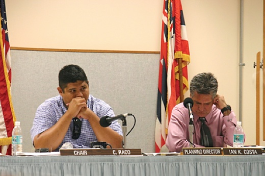
Image above: Planning Director Ian Costa, on the right, sitting by Planning Commission Chair Caven Raco at commission hearing. From source article.
[IB Editor's note: Whenever a bad planning request is to be made on Kauai, local lawyer Walton Hong will be on hand to represent Satan; and when that request is to be approved, planning director Ian Costa will be the stooge that supports it.]
Koloa and Po‘ipu house some of the richest archaeological sites in the entire state. Despite widespread development, new sites are still being discovered there.
Malama Maha‘ulepu, a Koloa-based nonprofit, claims mining activities may be polluting the pristine waters of Maha‘ulepu Beach while damaging the area’s cultural and historical resources.
“It’s important to remember who we were,” said Stella Bridges, a lineal descendant of native Hawaiians who lived there. Hawaiians used to grow many crops there and the area is still a source of fresh water, she said.
Malama Maha‘ulepu recently asked the Kaua‘i Planning Commission to review conditional permits for the New Maha‘ulepu Quarry transferred from the original applicant, Grove Farm Company, to Jas W. Glover Ltd.
The Maha‘ulepu Ahupua‘a was once a dense ancient Hawaiian village. Later, in the plantation days, it was there that the Old Koloa Mill operated. It has reportedly been the site of mining activities since the 1950s.
It is also in Maha‘ulepu, in a cave famous for its archaeological wealth, that the endemic Kaua‘i cave wolf spider and the Kaua‘i cave amphipod thrive. Both species were discovered in the 1971, are blind and only exist in fewer than a dozen caves. A 2005 study by the state government said counts have never documented more than 30 spiders and 80 amphipods.
The Old Maha‘ulepu Quarry started functioning since the mid 1950s, said Suzanne Kashiwaeda, president of the board of directors of Malama Maha‘ulepu. She said that a 1992 testimony before the commission shows the permit had been grandfathered.
The new quarry operates about a quarter mile northeast from there. Malama Maha‘ulepu members said that one of the conditions for the new quarry’s permit was that the old quarry would cease operations two years after the new one opened.
The new quarry’s permit is on its 17th year. But to this day the old quarry is reportedly still in operation. Rocks from the old quarry are transported to the old one, where they are crushed and washed, Kashiwaeda said.
The Maha‘ulepu cave sits on the edge of the old quarry. Farther up, inside the quarry, is the Waiopili heiau.
She also asked for site visits at the old and new quarries by the Planning Commission, the Land Use Commission, the Department of Health and the public.
Kashiwaeda showed the commission a map delineating the new quarry’s boundaries. About 42 acres are to be mined for limestone, which is the current activity; 25 acres are reserved for basalt mining; and another 41 acres are designated for operations and storage.
Malama Maha‘ulepu Board Vice President Napua Romo asked for the restoration of the Waiopili heiau, which she said was intended and promised back in 1992.
“Waiopili is more than one archaeological site,” she said, quoting a 1974 archaeological study that says the “the original setting which surrounds the site is as important as a site itself, including a pond, a spring, and a limestone cliff abutting the south side of the pond.”
Romo said the archaeologist recommended the heiau be stabilized and restored, and all quarrying operation which had adverse effects in the pond and the spring be stopped.
Jerry di Pietro, also from Malama Maha‘ulepu, showed pictures of a 2006 limestone rockslide near the cave, revealing bird footprints that are tens of thousands of years old.
Not far from there, the new quarry operators mine for the same limestone.
Kashiwaeda said that limestone was formed between 10,000 and 100,000 years ago. “All of that is being sold for roughly $56 a ton.”
Romo said some members of Malama Maha‘ulepu, plus a consultant and an archaeologist, trespassed on the property one weekend to visit the heiau.
“We wanted to find Waiopili heiau, particularly because some people said it was entirely gone,” she said.
Romo showed a 1974 picture of the heiau; compared with a picture taken recently, it suggests that only a couple rocks from the heiau remain in place.
“Since 1974 the heiau has certainly not been protected or cared for,” said Romo, adding that Malama Maha‘ulepu suggests that restoration should commence next June.
The landowner, she said, should fund a heiau restoration plan, complete with a consultant, cultural experts and community participation. She also said restoration work should be open to the public during daylight hours.
Romo said if the heiau is found damaged beyond the condition described in 1974, the responsible parties should be fined no less than $1 million. The money would be put in a trust to support the Koloa communities and nonprofits that take care of the remaining cultural sites in the area.
“We have a permit with a number of conditions. We’ve heard allegations that these conditions have not been met.” said Walton Hong, Glover’s attorney. “We’ve not had a chance to respond to them.”
Hong said his client is in the process of preparing a report to be delivered to the Planning Department. Only then the department will be able to decide if there’s any merit to the permit violation allegations, he said.
“We started on it. It’s a mass of material we have to get through; it’s not just a couple pieces of paper,” said Hong, adding that he should get the report ready in 30 days.
Commissioner Jimmy Nishida reminded Hong that regardless of the recommendations of the planning director, the commission still may initiate Chapter 12.
Meanwhile, the community is seeking cooperation.
“We are lay people, we are not lawyers or planners,” Kashiwaeda told Hong, explaining that even though they have been adversaries in the past, Malama Maha‘ulepu would rather work things out.
“Our point is, we want to save the important historic, cultural sites,” she said. “If we can work together that’s what we would like to do.”
The site, however, is currently off limits to the public.
“We don’t have access to the place,” Kashiwaeda said. “We don’t have access to the information. They hold all the cards.”
After receiving the report from Glover, the planning director will decide on the next action.
“I take my responsibility very seriously, especially as a kanaka maoli,” said Planning Director Ian Costa.
“I will provide information to the commission on whether the information provided is satisfactory,” Costa said. “Depending on how that information goes, we would not hesitate to file a petition (for Chapter 12).”.
By Leo Azambuja on 26 May 2010 in Garden Island News - (http://thegardenisland.com/news/local/article_84e275ae-6894-11df-b5d1-001cc4c002e0.html)
Image above: Planning Director Ian Costa, on the right, sitting by Planning Commission Chair Caven Raco at commission hearing. From source article.
[IB Editor's note: Whenever a bad planning request is to be made on Kauai, local lawyer Walton Hong will be on hand to represent Satan; and when that request is to be approved, planning director Ian Costa will be the stooge that supports it.]
Koloa and Po‘ipu house some of the richest archaeological sites in the entire state. Despite widespread development, new sites are still being discovered there.
Malama Maha‘ulepu, a Koloa-based nonprofit, claims mining activities may be polluting the pristine waters of Maha‘ulepu Beach while damaging the area’s cultural and historical resources.
“It’s important to remember who we were,” said Stella Bridges, a lineal descendant of native Hawaiians who lived there. Hawaiians used to grow many crops there and the area is still a source of fresh water, she said.
Malama Maha‘ulepu recently asked the Kaua‘i Planning Commission to review conditional permits for the New Maha‘ulepu Quarry transferred from the original applicant, Grove Farm Company, to Jas W. Glover Ltd.
The Maha‘ulepu Ahupua‘a was once a dense ancient Hawaiian village. Later, in the plantation days, it was there that the Old Koloa Mill operated. It has reportedly been the site of mining activities since the 1950s.
It is also in Maha‘ulepu, in a cave famous for its archaeological wealth, that the endemic Kaua‘i cave wolf spider and the Kaua‘i cave amphipod thrive. Both species were discovered in the 1971, are blind and only exist in fewer than a dozen caves. A 2005 study by the state government said counts have never documented more than 30 spiders and 80 amphipods.
The Old Maha‘ulepu Quarry started functioning since the mid 1950s, said Suzanne Kashiwaeda, president of the board of directors of Malama Maha‘ulepu. She said that a 1992 testimony before the commission shows the permit had been grandfathered.
The new quarry operates about a quarter mile northeast from there. Malama Maha‘ulepu members said that one of the conditions for the new quarry’s permit was that the old quarry would cease operations two years after the new one opened.
The new quarry’s permit is on its 17th year. But to this day the old quarry is reportedly still in operation. Rocks from the old quarry are transported to the old one, where they are crushed and washed, Kashiwaeda said.
The Maha‘ulepu cave sits on the edge of the old quarry. Farther up, inside the quarry, is the Waiopili heiau.
Revise permit conditions
Kashiwaeda asked the commission to revise the conditions for the new quarry, amending it to better monitor the quarry’s activities, and expedite the Waiopili heiau restoration at the old quarry.She also asked for site visits at the old and new quarries by the Planning Commission, the Land Use Commission, the Department of Health and the public.
Kashiwaeda showed the commission a map delineating the new quarry’s boundaries. About 42 acres are to be mined for limestone, which is the current activity; 25 acres are reserved for basalt mining; and another 41 acres are designated for operations and storage.
Malama Maha‘ulepu Board Vice President Napua Romo asked for the restoration of the Waiopili heiau, which she said was intended and promised back in 1992.
“Waiopili is more than one archaeological site,” she said, quoting a 1974 archaeological study that says the “the original setting which surrounds the site is as important as a site itself, including a pond, a spring, and a limestone cliff abutting the south side of the pond.”
Romo said the archaeologist recommended the heiau be stabilized and restored, and all quarrying operation which had adverse effects in the pond and the spring be stopped.
Jerry di Pietro, also from Malama Maha‘ulepu, showed pictures of a 2006 limestone rockslide near the cave, revealing bird footprints that are tens of thousands of years old.
Not far from there, the new quarry operators mine for the same limestone.
Kashiwaeda said that limestone was formed between 10,000 and 100,000 years ago. “All of that is being sold for roughly $56 a ton.”
Romo said some members of Malama Maha‘ulepu, plus a consultant and an archaeologist, trespassed on the property one weekend to visit the heiau.
“We wanted to find Waiopili heiau, particularly because some people said it was entirely gone,” she said.
Romo showed a 1974 picture of the heiau; compared with a picture taken recently, it suggests that only a couple rocks from the heiau remain in place.
“Since 1974 the heiau has certainly not been protected or cared for,” said Romo, adding that Malama Maha‘ulepu suggests that restoration should commence next June.
The landowner, she said, should fund a heiau restoration plan, complete with a consultant, cultural experts and community participation. She also said restoration work should be open to the public during daylight hours.
Romo said if the heiau is found damaged beyond the condition described in 1974, the responsible parties should be fined no less than $1 million. The money would be put in a trust to support the Koloa communities and nonprofits that take care of the remaining cultural sites in the area.
Commission considers taking action
The commission made a motion to initiate Chapter 12, which has the power to revoke or modify the permit, but went back and decided to first receive a report from the Planning Department.“We have a permit with a number of conditions. We’ve heard allegations that these conditions have not been met.” said Walton Hong, Glover’s attorney. “We’ve not had a chance to respond to them.”
Hong said his client is in the process of preparing a report to be delivered to the Planning Department. Only then the department will be able to decide if there’s any merit to the permit violation allegations, he said.
“We started on it. It’s a mass of material we have to get through; it’s not just a couple pieces of paper,” said Hong, adding that he should get the report ready in 30 days.
Commissioner Jimmy Nishida reminded Hong that regardless of the recommendations of the planning director, the commission still may initiate Chapter 12.
Meanwhile, the community is seeking cooperation.
“We are lay people, we are not lawyers or planners,” Kashiwaeda told Hong, explaining that even though they have been adversaries in the past, Malama Maha‘ulepu would rather work things out.
“Our point is, we want to save the important historic, cultural sites,” she said. “If we can work together that’s what we would like to do.”
The site, however, is currently off limits to the public.
“We don’t have access to the place,” Kashiwaeda said. “We don’t have access to the information. They hold all the cards.”
After receiving the report from Glover, the planning director will decide on the next action.
“I take my responsibility very seriously, especially as a kanaka maoli,” said Planning Director Ian Costa.
“I will provide information to the commission on whether the information provided is satisfactory,” Costa said. “Depending on how that information goes, we would not hesitate to file a petition (for Chapter 12).”.
No comments :
Post a Comment