SUBHEAD: The good news is that many places near people suffering from hunger can grow breadfruit.
By Matthew Lucas & Diane Ragone in June 2012 in ArcView News -
(http://www.esri.com/news/arcnews/summer12articles/will-breadfruit-solve-the-world-hunger-crisis.html)
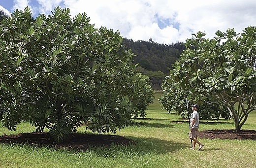
Image above: Different varieties of breadfruit are conserved in the world's largest collection of breadfruit at the Breadfruit Institute in Hawaii.
A map can be a powerful visual tool, but can a map help solve world hunger, rejuvenate agricultural soil, and prevent mosquito-borne infections? Can a map help slow global warming and spur sustainable economic development in tropical regions around the world? Perhaps a map alone can't do these things, but a map can help display the real potential of a very special tree, the breadfruit.
Breadfruit (Artocarpus altilis) is a tropical tree originally from Papua New Guinea with a rich and storied history. This starchy staple crop has been grown in the Pacific for close to 3,000 years and was first introduced to other tropical regions more than 200 years ago. The trees are easy to grow and thrive under a wide range of ecological conditions, producing abundant, nutritious food for decades without the labor, fertilizer, and chemicals used to grow field crops.
These multipurpose trees improve soil conditions and protect watersheds while providing food, timber, and animal feed. All parts of the tree are used—even the male flowers, which are dried and burned to repel mosquitoes. Because of its multiple uses and long, productive, low-maintenance life, breadfruit was spread throughout the tropical Pacific by intrepid voyagers. Hawaii is one of the many island chains where breadfruit, or ulu in Hawaiian, was cultivated as a major staple. It is fitting that now Hawaii is home to the headquarters of an organization devoted to promoting the conservation and use of breadfruit for food and reforestation around the world.
The Breadfruit Institute, within the nonprofit National Tropical Botanical Garden (NTBG), is a major center for the tree's conservation and research of more than 120 varieties from throughout the Pacific, making it the world's largest repository of breadfruit. As a result of this work, the institute has received requests from numerous countries seeking quality breadfruit varieties for tree-planting projects. To address this need, the Breadfruit Institute has developed innovative propagation methods, making it possible to produce and ship thousands, or even millions, of breadfruit plants anywhere in the world.
These breadfruit tree-planting projects can help alleviate hunger and support sustainable agriculture, agroforestry, and income generation. Most of the world's one billion hungry people live in the tropics—the same region where breadfruit can be grown. However, as Dr. Diane Ragone, author and director of the Breadfruit Institute, has learned, stating these facts and illustrating them are two very different things. A strong realization is made when a person sees the data from the United Nations Food and Agriculture Organization global map on world hunger coupled with a map showing areas suitable for growing breadfruit.
It was originally this type of powerful visual aid Ragone wanted when she began working with NTBG's GIS coordinator and coauthor Matthew Lucas. To create such a map, Lucas began by constructing a model within ArcGIS using WorldClim 30-second resolution global raster datasets of interpolated climate conditions compiled from the past 50 years (Hijmans et al. 2005). With the GIS, monthly rainfall and temperature data was condensed into total annual rainfall, mean annual temperature, and minimum and maximum annual temperature. Then, the annual climate data was reclassified.

Image above: Map of world showing zones of "best" and "suitable" growing conditions for breadfruit as well as Hunger map is based on the 2011 Global Hunger Index score displayed per country. From (http://ntbg.org/breadfruit/resources/#1160).
"Suitable" and "best" ranges of rainfall and temperature were identified after referring to the breadfruit profile written by Ragone for Traditional Trees of Pacific Islands (Elevitch 2006). The best ranges in mean temperature and rainfall were given a value of 2, whereas suitable conditions were given a value of 1; conditions that were deemed too low or high were given a value of -10. ArcGIS was used to combine all the reclassified climate datasets.
The final output resulted in a global dataset that now displayed areas deemed unsuitable for growing breadfruit as < 0, areas assumed suitable with a value of < 4 and > 0, and best areas with a value of 4. This data was displayed in combination with 2011 Global Hunger Index scores entered into a vector dataset of countries. The resultant map helps the viewer see the real potential breadfruit development could have for tropical regions.
With this new visual aid completed, Ragone and Josh Schneider, cofounder of Cultivaris/Global Breadfruit, a horticultural partner that propagates breadfruit trees for global distribution, attended the World Food Prize symposium in October 2011. The breadfruit suitability map was shared with Calestous Juma, professor of the practice of international development and director of the Science, Technology, and Globalization Project at the Belfer Center for Science and International Affairs at the Harvard Kennedy School. Juma has extensive experience and contacts in Africa.
The map was also shared with the former president of Nigeria, Olusegun Obasanjo. It was at Obasanjo's invitation that Schneider visited Nigeria and met with government officials and researchers to discuss breadfruit planting projects. Due to the relatively fine scale (1 km) of the original datasets, a more detailed map of Nigeria showing areas suitable for growing breadfruit, along with roads and cities, was an invaluable tool during discussions.
The World Food Prize meeting also spurred other similar country-specific maps that have been created and shared with organizations and individuals working in Haiti, Ghana, Jamaica, Central America, and China. The maps provide government officials, foundations, and potential donors with clear information about the potential of breadfruit in specific areas. The maps have spurred the question, What other countries are best suited for growing breadfruit? ArcGIS was used to combine the breadfruit suitability data with a vector layer of country borders. This not only resulted in a list of countries that could possibly grow breadfruit but also made it easy to identify and rank the amount of area each country has that is suitable and best for growing breadfruit.
It became clear that this map, the data, and the ArcGIS methodology used to construct it provided not only a powerful visual aid but also a useful research tool. Armed with these maps and the information they convey, Lucas and Ragone are continuing to pair what has been learned about breadfruit cultivation with ArcGIS to help understand and display future breadfruit potential. They are currently working on a climate change analysis that uses predicted climate datasets of various future climate models and scenarios in an attempt to quantify areas that would have the highest likelihood of sustainable breadfruit development. They are also working on publishing an online map displaying global breadfruit growing potential. Finally, it is the hope of the Breadfruit Institute and NTBG that future breadfruit development will be expanded and that ArcGIS will help guide potential breadfruit-growing countries in planning and implementing planting projects of this very special tree.
About the Authors
Matthew Lucas is the GIS coordinator for the Conservation Department at the National Tropical Botanical Garden. As a graduate of the University of Hawaii, Hilo, Department of Geography, Lucas hails from a conservation background where he uses models and maps to guide more efficient decision making and problem solving.
Diane Ragone, PhD, is director of the Breadfruit Institute at the National Tropical Botanical Garden. She is an authority on the conservation and use of breadfruit and has conducted horticultural and ethnobotanical studies in more than 50 islands in Micronesia, Polynesia, and Melanesia.
For more information about the Breadfruit Institute and NTBG, visit www.ntbg.org/breadfruit.
To help support the work of the institute and breadfruit tree-planting projects, visit ntbg.org/breadfruit/donate/plantatree.php. For more information on Global Breadfruit and how you can help, visit www.globalbreadfruit.com.
Ragone, D. (2006). "Artocarpus altilis (breadfruit)." In Traditional Trees of Pacific Islands. Elevitch, C. R. (ed). Holualoa, HI: Permanent Agroforestry Resources, 85–100. Available at www.traditionaltree.org.
Von Grebmer, K., M. Torero, T. Olofinbiyi, et al. (2011). "2011 Global Hunger Index: The Challenge of Hunger: Taming Price Spikes and Excessive Food Price Volatility." International Food Policy Research Institute, Bonn. Available at www.ifpri.org/sites/default/files/publications/ghi11.pdf [PDF].
See also: Ea O Ka Aina: Trees that Feed 4/25/12 Ea O Ka Aina: Plant a Breadfruit Tree 3/31/10 Ea O Ka Aina: Breadfruit Recipe Experiments 11/15/09 Ea O Ka Aina: Get out your `ulu! 7/14/09 Island Breath: Ulu - The Breadfruit Tree 12/31/06
.
By Matthew Lucas & Diane Ragone in June 2012 in ArcView News -
(http://www.esri.com/news/arcnews/summer12articles/will-breadfruit-solve-the-world-hunger-crisis.html)
Image above: Different varieties of breadfruit are conserved in the world's largest collection of breadfruit at the Breadfruit Institute in Hawaii.
A map can be a powerful visual tool, but can a map help solve world hunger, rejuvenate agricultural soil, and prevent mosquito-borne infections? Can a map help slow global warming and spur sustainable economic development in tropical regions around the world? Perhaps a map alone can't do these things, but a map can help display the real potential of a very special tree, the breadfruit.
Breadfruit (Artocarpus altilis) is a tropical tree originally from Papua New Guinea with a rich and storied history. This starchy staple crop has been grown in the Pacific for close to 3,000 years and was first introduced to other tropical regions more than 200 years ago. The trees are easy to grow and thrive under a wide range of ecological conditions, producing abundant, nutritious food for decades without the labor, fertilizer, and chemicals used to grow field crops.
These multipurpose trees improve soil conditions and protect watersheds while providing food, timber, and animal feed. All parts of the tree are used—even the male flowers, which are dried and burned to repel mosquitoes. Because of its multiple uses and long, productive, low-maintenance life, breadfruit was spread throughout the tropical Pacific by intrepid voyagers. Hawaii is one of the many island chains where breadfruit, or ulu in Hawaiian, was cultivated as a major staple. It is fitting that now Hawaii is home to the headquarters of an organization devoted to promoting the conservation and use of breadfruit for food and reforestation around the world.
The Breadfruit Institute, within the nonprofit National Tropical Botanical Garden (NTBG), is a major center for the tree's conservation and research of more than 120 varieties from throughout the Pacific, making it the world's largest repository of breadfruit. As a result of this work, the institute has received requests from numerous countries seeking quality breadfruit varieties for tree-planting projects. To address this need, the Breadfruit Institute has developed innovative propagation methods, making it possible to produce and ship thousands, or even millions, of breadfruit plants anywhere in the world.
These breadfruit tree-planting projects can help alleviate hunger and support sustainable agriculture, agroforestry, and income generation. Most of the world's one billion hungry people live in the tropics—the same region where breadfruit can be grown. However, as Dr. Diane Ragone, author and director of the Breadfruit Institute, has learned, stating these facts and illustrating them are two very different things. A strong realization is made when a person sees the data from the United Nations Food and Agriculture Organization global map on world hunger coupled with a map showing areas suitable for growing breadfruit.
It was originally this type of powerful visual aid Ragone wanted when she began working with NTBG's GIS coordinator and coauthor Matthew Lucas. To create such a map, Lucas began by constructing a model within ArcGIS using WorldClim 30-second resolution global raster datasets of interpolated climate conditions compiled from the past 50 years (Hijmans et al. 2005). With the GIS, monthly rainfall and temperature data was condensed into total annual rainfall, mean annual temperature, and minimum and maximum annual temperature. Then, the annual climate data was reclassified.
Image above: Map of world showing zones of "best" and "suitable" growing conditions for breadfruit as well as Hunger map is based on the 2011 Global Hunger Index score displayed per country. From (http://ntbg.org/breadfruit/resources/#1160).
"Suitable" and "best" ranges of rainfall and temperature were identified after referring to the breadfruit profile written by Ragone for Traditional Trees of Pacific Islands (Elevitch 2006). The best ranges in mean temperature and rainfall were given a value of 2, whereas suitable conditions were given a value of 1; conditions that were deemed too low or high were given a value of -10. ArcGIS was used to combine all the reclassified climate datasets.
The final output resulted in a global dataset that now displayed areas deemed unsuitable for growing breadfruit as < 0, areas assumed suitable with a value of < 4 and > 0, and best areas with a value of 4. This data was displayed in combination with 2011 Global Hunger Index scores entered into a vector dataset of countries. The resultant map helps the viewer see the real potential breadfruit development could have for tropical regions.
With this new visual aid completed, Ragone and Josh Schneider, cofounder of Cultivaris/Global Breadfruit, a horticultural partner that propagates breadfruit trees for global distribution, attended the World Food Prize symposium in October 2011. The breadfruit suitability map was shared with Calestous Juma, professor of the practice of international development and director of the Science, Technology, and Globalization Project at the Belfer Center for Science and International Affairs at the Harvard Kennedy School. Juma has extensive experience and contacts in Africa.
The map was also shared with the former president of Nigeria, Olusegun Obasanjo. It was at Obasanjo's invitation that Schneider visited Nigeria and met with government officials and researchers to discuss breadfruit planting projects. Due to the relatively fine scale (1 km) of the original datasets, a more detailed map of Nigeria showing areas suitable for growing breadfruit, along with roads and cities, was an invaluable tool during discussions.
The World Food Prize meeting also spurred other similar country-specific maps that have been created and shared with organizations and individuals working in Haiti, Ghana, Jamaica, Central America, and China. The maps provide government officials, foundations, and potential donors with clear information about the potential of breadfruit in specific areas. The maps have spurred the question, What other countries are best suited for growing breadfruit? ArcGIS was used to combine the breadfruit suitability data with a vector layer of country borders. This not only resulted in a list of countries that could possibly grow breadfruit but also made it easy to identify and rank the amount of area each country has that is suitable and best for growing breadfruit.
It became clear that this map, the data, and the ArcGIS methodology used to construct it provided not only a powerful visual aid but also a useful research tool. Armed with these maps and the information they convey, Lucas and Ragone are continuing to pair what has been learned about breadfruit cultivation with ArcGIS to help understand and display future breadfruit potential. They are currently working on a climate change analysis that uses predicted climate datasets of various future climate models and scenarios in an attempt to quantify areas that would have the highest likelihood of sustainable breadfruit development. They are also working on publishing an online map displaying global breadfruit growing potential. Finally, it is the hope of the Breadfruit Institute and NTBG that future breadfruit development will be expanded and that ArcGIS will help guide potential breadfruit-growing countries in planning and implementing planting projects of this very special tree.
About the Authors
Matthew Lucas is the GIS coordinator for the Conservation Department at the National Tropical Botanical Garden. As a graduate of the University of Hawaii, Hilo, Department of Geography, Lucas hails from a conservation background where he uses models and maps to guide more efficient decision making and problem solving.
Diane Ragone, PhD, is director of the Breadfruit Institute at the National Tropical Botanical Garden. She is an authority on the conservation and use of breadfruit and has conducted horticultural and ethnobotanical studies in more than 50 islands in Micronesia, Polynesia, and Melanesia.
For more information about the Breadfruit Institute and NTBG, visit www.ntbg.org/breadfruit.
To help support the work of the institute and breadfruit tree-planting projects, visit ntbg.org/breadfruit/donate/plantatree.php. For more information on Global Breadfruit and how you can help, visit www.globalbreadfruit.com.
Citations
Hijmans, R. J., S. E. Cameron, J. L. Parra, P. G. Jones, and A. Jarvis (2005). "Very High Resolution Interpolated Climate Surfaces for Global Land Areas." International Journal of Climatology 25:1965–1978.Ragone, D. (2006). "Artocarpus altilis (breadfruit)." In Traditional Trees of Pacific Islands. Elevitch, C. R. (ed). Holualoa, HI: Permanent Agroforestry Resources, 85–100. Available at www.traditionaltree.org.
Von Grebmer, K., M. Torero, T. Olofinbiyi, et al. (2011). "2011 Global Hunger Index: The Challenge of Hunger: Taming Price Spikes and Excessive Food Price Volatility." International Food Policy Research Institute, Bonn. Available at www.ifpri.org/sites/default/files/publications/ghi11.pdf [PDF].
See also: Ea O Ka Aina: Trees that Feed 4/25/12 Ea O Ka Aina: Plant a Breadfruit Tree 3/31/10 Ea O Ka Aina: Breadfruit Recipe Experiments 11/15/09 Ea O Ka Aina: Get out your `ulu! 7/14/09 Island Breath: Ulu - The Breadfruit Tree 12/31/06
.
No comments :
Post a Comment